브라우닝 지방 자치체 34호
Rural Municipality of Browning No. 34브라우닝 34호 | |
|---|---|
| 브라우닝 지방 자치체 34호 | |
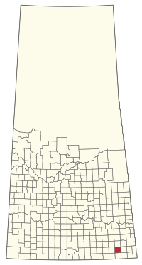
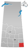
 서스캐처원 브라우닝 34호 RM 위치 | |
| 좌표:49°23°20°N 102°39′00″w/49.389°N 102.650°W좌표: 49°23°20°N 102°39 †00 † W / 49.389°N 102.650°W / [1] | |
| 나라 | 캐나다 |
| 지방 | 서스캐처원 주 |
| 인구 조사과 | 1 |
| SARM 분할 | 1 |
| 페더럴 라이딩 | Souris: 무스산 |
| 지방승마 | 캐닝턴 |
| 형성된[2] | 1911년 12월 11일 |
| 정부 | |
| • 리브 | 피우스 루스텔 |
| • 이사회 | 브라우닝 34호 평의회 RM |
| • 관리자 | 데나 스콧 |
| • 사무실 소재지 | 램프맨 |
| 지역 (2016년)[4] | |
| • 토지 | 823.38km2(317.91평방마일) |
| 인구. (2016년)[4] | |
| • 합계 | 375 |
| • 밀도 | 0.5/km2(1/160mi) |
| 시간대 | CST |
| • 여름 (DST) | CST |
| 우편번호 | S0C 1N0 |
| 지역 번호 | 306 및 639 |
| 웹 사이트 | 공식 웹사이트 |
브라우닝 지방 자치체 34호(2016년 인구: 375명)는 캐나다 서스캐처원 주에 있는 지방 자치체이다.
역사
브라우닝 34호의 RM은 [2]1911년 12월 11일 농촌 자치체로 편입되었다.1912년에 RM의 인구는 1,[5]800명이었다.
인구 통계
캐나다 통계청이 실시한 2021년 인구총조사에서 브라우닝 34호의 RM은 총 172개의 민간 주거지 중 146개에 355명의 인구가 살고 있었으며, 이는 2016년 인구 375명보다 -5.3% 증가한 것이다.면적은 797km2(308평방마일)로 2021년 [8]인구밀도는 0.4/km2(1.2/sq마일)였다.
2016년 인구조사에서 브라우닝 34호 RM은 전체 163개 민간 주택 중 144개 주택에 375명의 인구가 살고 있으며, 이는 2011년 인구 399명보다 -6% 증가한 것이다.면적은 823.38km2(317.91평방마일)로 2016년 [4]인구밀도는 0.5km/km2(1.2평방마일)였다.
정부
브라우닝 34호의 RM은 선출된 시의회와 매달 [3]둘째 주 수요일에 열리는 임명된 관리자에 의해 관리된다.RM의 리브는 Pius Loustel이고 관리자는 Dena [3]Scott입니다.RM의 사무실은 [3]Lampman에 있습니다.
교통.
Lampman 공항은 지방 [citation needed]자치체 내에 있습니다.
레퍼런스
- ^ "Pre-packaged CSV files - CGN, Canada/Province/Territory (cgn_sk_csv_eng.zip)". Government of Canada. July 24, 2019. Retrieved May 23, 2020.
- ^ a b "Rural Municipality Incorporations (Alphabetical)". Saskatchewan Ministry of Municipal Affairs. Archived from the original on April 21, 2011. Retrieved May 9, 2020.
- ^ a b c d "Municipality Details: RM of Browning No. 34". Government of Saskatchewan. Retrieved May 21, 2020.
- ^ a b c "Population and dwelling counts, for Canada, provinces and territories, and census subdivisions (municipalities), 2016 and 2011 censuses – 100% data (Saskatchewan)". Statistics Canada. February 8, 2017. Retrieved May 1, 2020.
- ^ 사스크비즈
- ^ "Saskatchewan Census Population" (PDF). Saskatchewan Bureau of Statistics. Archived from the original (PDF) on September 24, 2015. Retrieved May 9, 2020.
- ^ "Saskatchewan Census Population". Saskatchewan Bureau of Statistics. Retrieved May 9, 2020.
- ^ "Population and dwelling counts: Canada, provinces and territories, census divisions and census subdivisions (municipalities), Saskatchewan". Statistics Canada. February 9, 2022. Retrieved April 13, 2022.


