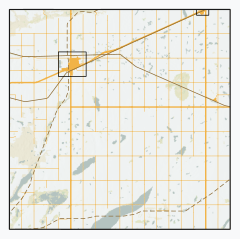
세인트 농촌 자치구앤드루스 제287호
Rural Municipality of St.세인트 앤드루스 287번 | |
|---|---|
| 세인트 농촌 자치구앤드루스 제287호 | |
 성 RM의 성(RM서스캐처원 앤드루스 287호 | |
| 좌표:51°31′41″N 107°55′19″w/51.528°N 107.922°W좌표: 51°31′41″N 107°55′19″W / 51.528°N 107.922°W/ [1] | |
| 나라 | 캐나다 |
| 주 | 서스캐처원 |
| 인구조사과 | 12 |
| SARM 분할 | 6 |
| 형성된[2] | 1910년 12월 12일 |
| 정부 | |
| • 리브 | 제프 레게 |
| • 관리 기관 | 성 RM앤드루스 287번 평의회 |
| • 관리자 | 조앤 베이비시 |
| • 사무소 위치 | 로제타운 |
| 면적 (2016)[4] | |
| • 육지 | 803.75km2 (1983.33 sq mi) |
| 인구 (2016)[4] | |
| • 합계 | 522 |
| • 밀도 | 0.6/km2(2/sq mi) |
| 시간대 | CST |
| • 여름(DST) | CST |
| 지역 번호 | 306년과 639년 |
[시론] 세인트의 농촌 자치구 앤드류스 287호(2016년 인구: 522년)는 인구조사과 12번과 6번 중과 내에 있는 캐나다 서스캐처원 주의 농촌 자치주(RM)이다.
역사
세인트루이스의 RM.앤드류스 287호는 1910년 12월 12일 농촌 자치 단체로 설립되었다.[2]
지리
지역사회 및 지역
다음의 도시 자치단체들은 RM에 둘러싸여 있다.
다음의 비법인 공동체는 RM 내에 있다.
- 소버린 (마을로 분해, 2005년 12월 31일)
- 지역
인구통계학
캐나다 통계청이 실시한 2016년 인구총조사에서 성인의 RM은 다음과 같다.앤드류스 287호는 전체 민간주택 179개 중 160개에서 522명의 인구를 기록, 2011년 532개에서 -1.9%의 변화율을 보였다.국토면적이 803.75km2(310.33sqmi)로 2016년 인구밀도가 0.6km2(1.7/sqmi)에 달했다.[4]
2011년 인구조사에서 성(聖)의 R.M.Andrews No. 287은 532명의 인구를 기록했는데, 이는 2006년 인구 582명에서 -8.6%의 변화였다.국토면적이 803.75km2(310.33sqmi)로 2011년에는 인구밀도가 0.7/km2(1.7/sqmi)로 나타났다.[7]
정부
세인트루이스의 RM.Andrews No. 287은 선출된 시의회와 지명된 행정관이 관리하며, 이 행정관은 매월 둘째 주 화요일에 회의를 갖는다.[3]RM의 리브는 Geoff Regge이고, 그것의 관리자는 Joan Babbcy이다.[3]RM의 사무실은 로제타운에 있다.[3]
교통
참고 항목
참조
- ^ "Pre-packaged CSV files - CGN, Canada/Province/Territory (cgn_sk_csv_eng.zip)". Government of Canada. July 24, 2019. Retrieved May 23, 2020.
- ^ a b "Rural Municipality Incorporations (Alphabetical)". Saskatchewan Ministry of Municipal Affairs. Archived from the original on April 21, 2011. Retrieved May 9, 2020.
- ^ a b c d "Municipality Details: RM of St. Andrews No. 287". Government of Saskatchewan. Retrieved May 21, 2020.
- ^ a b c "Population and dwelling counts, for Canada, provinces and territories, and census subdivisions (municipalities), 2016 and 2011 censuses – 100% data (Saskatchewan)". Statistics Canada. February 8, 2017. Retrieved May 1, 2020.
- ^ "Saskatchewan Census Population" (PDF). Saskatchewan Bureau of Statistics. Archived from the original (PDF) on September 24, 2015. Retrieved May 9, 2020.
- ^ "Saskatchewan Census Population". Saskatchewan Bureau of Statistics. Retrieved May 9, 2020.
- ^ "Population and dwelling counts, for Canada, provinces and territories, and census subdivisions (municipalities), 2011 and 2006 censuses (Saskatchewan)". Statistics Canada. June 3, 2019. Retrieved May 1, 2020.


