앨런커, 파라
Alenquer, Pará앨런커 | |
|---|---|
시 | |
 | |
| 좌표: 1°56′41″S 54°43′55″w / 1.944818°S 54.732019°W좌표: 1°56′41″S 54°43′55″W / 1.944818°S 54.73°W/ . | |
| 나라 | |
| 지역 | 북부 |
| 주 | 파라 |
| 메소레지온 | 바이쇼 아마조나스 |
| 인구 (2020 [1]) | |
| • 합계 | 57,092 |
| 시간대 | UTC -3 |
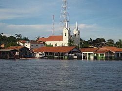
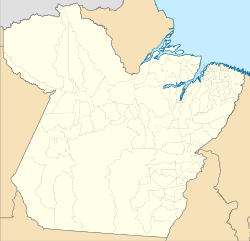
앨런커는 브라질 북부 파라 주에 있는 자치 단체다.[2][3][4][5] 이 마을은 대략 산타렘 시 건너편에 있는 아마존 강의 북쪽 둑에 위치해 있다.
보존
이 시군은 2001년에 만들어진 지속 가능한 사용 보존 단위인 물라타 국립 산림 21만6,601헥타르(53만5,230에이커)의 약 절반을 포함하고 있다.[7] 자치구 북쪽에는 지구상에서 가장 많이 보호되는 열대림 보전 단위인 상파라 생태역 424만5819ha(1049만1650에이커)의 일부(13.31%)가 포함돼 있다.[8] 2006년 조성된 트롬베타스 주립 산림 3,172,978ha(78만4,600에이커)의 2%를 함유하고 있다.[9]
저명인사
참고 항목
참조
- ^ IBGE 2020
- ^ "Divisão Territorial do Brasil" (in Portuguese). Divisão Territorial do Brasil e Limites Territoriais, Instituto Brasileiro de Geografia e Estatística (IBGE). July 1, 2008. Retrieved December 17, 2009.
- ^ "Estimativas da população para 1º de julho de 2009" (PDF) (in Portuguese). Estimativas de População, Instituto Brasileiro de Geografia e Estatística (IBGE). August 14, 2009. Retrieved December 17, 2009.
- ^ "Ranking decrescente do IDH-M dos municípios do Brasil" (in Portuguese). Atlas do Desenvolvimento Humano, Programa das Nações Unidas para o Desenvolvimento (PNUD). 2000. Archived from the original on October 3, 2009. Retrieved December 17, 2009.
- ^ "Produto Interno Bruto dos Municípios 2002-2005" (PDF) (in Portuguese). Instituto Brasileiro de Geografia e Estatística (IBGE). December 19, 2007. Archived from the original (PDF) on October 2, 2008. Retrieved December 17, 2009.
- ^ "Aeródromos". ANAC (in Portuguese). 29 June 2020. Retrieved 8 April 2021.
- ^ FLONA de Mulata (in Portuguese), ISA: Instituto Socioambiental, retrieved 2016-06-01
- ^ Estação Ecológica Grão-Pará (in Portuguese), Ideflor-bio (Government of Pará), retrieved 2016-05-12
- ^ FES do Trombetas (in Portuguese), ISA: Instituto Socioambiental, retrieved 2016-09-07
- ^ "Delival da Fonseca". Olympedia.org. Retrieved 8 April 2021.
| 위키미디어 커먼즈에는 앨리커(파라)와 관련된 미디어가 있다. |


