미드 래브라도 리지
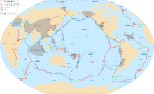
Mid-Labrador Ridge미드 래브라도 리지는 래브라도 해의 중간 산등성이로, 고생대 시절 그린란드 판과 북미 판 사이의 상이한 경계를 나타내었다. 산등성이는 남동쪽에 있는 남그린란드 트리플 분기점에서 북서쪽에 있는 데이비스 해협까지 뻗어 있었다.[1] 미드 라브라도 능선을 따라 펼쳐지는 해저면은 약 4천만년 전에 중오션 능선이 본질적으로 멸종되면서 단종되었다.[2]
미드 래브라도 능선은 현재 대부분 침전물 밑에 묻혀 있는데, 이는 래브라도 분지의 남동부에서 북풍적인 해산의 추세로만 드러난 것이다.[3]
참조
- ^ Oakey, Gordon N.; Stephenson, Randell (2008). "Crustal structure of the Innuitian region of Arctic Canada and Greenland from gravity modelling: implications for the Palaeogene Eurekan orogen". Geophysical Journal International. Royal Astronomical Society. 173 (3): 1041. doi:10.1111/j.1365-246X.2008.03784.x. ISSN 0956-540X.
- ^ Herman, Yvonne (1974). Marine Geology and Oceanography of the Arctic Seas. Springer-Verlag. p. 92. ISBN 978-3-642-87413-0.
- ^ Litvin, V. M. (1984). The Morphostructure of the Atlantic Ocean Floor: Its Development in the Meso-Cenozoic. Dordrecht, Holland: D. Reidel Publishing Company. p. 29. ISBN 978-94-009-6247-7.


