물라코르
Mullacor| 물라코르 | |
|---|---|
| 물라이 모르 | |
 Lugduff 경사면에서 보기 | |
| 최고점 | |
| 표고 | 661m(2,520ft)[1] |
| 두각을 나타남 | 102m(335ft)[1] |
| 격리 | 3.27km(2.03mi) |
| 목록 | 100개의 가장 높은 아일랜드 산맥, 휴이트, 아르데린, 심, 밴델리에르-리남 |
| 좌표 | 52°59′6″n 6°22′26″W/52.98500°N 6.37389°W좌표: 52°59′6″N 6°22′26″W / 52.98500°N 6.37389°W/ |
| 이름 지정 | |
| 영어 번역 | 큰 언덕 꼭대기 |
| 이름 언어 | 아일랜드어 |
| 지리 | |
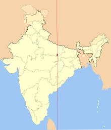
 물라코르 아일랜드의 위치 | |
| 위치 | 위클로우, 아일랜드 |
| 상위 범위 | 위클로우 산맥 |
| OSI/OSNI 그리드 | T0927493925 |
| 토포 지도 | OSi Discovery 56 |
| 지질학 | |
| 산형 | 다크 블루 그레이 슬레이트, 필라이트 & 쉬스트[1] |
물라코르(Irish: Mullaigh Mohr, '큰 언덕 꼭대기'[2]라는 뜻)는 아일랜드의 산이다.
특징들

서밋 케언, 투루 언덕 전망
물라코르는 아르데린 척도로 아일랜드에서 141번째로 높은 봉우리,[3] 반델레르-리남 척도로 172번째로 높은 봉우리다.[4][5]It's situated in the southern sector of the Wicklow Mountains range, and forms a broad horseshoe around the Upper Lake of the Glendalough valley with the mountains of Lugduff 652 metres (2,139 ft), Conavalla 734 metres (2,408 ft), the hydroelectric station at Turlough Hill 681 metres (2,234 ft), and Camaderry 699 metres (2,293 ft).[5]물라코르의 서쪽 옆구리는 인접한 글렌말루 계곡의 층계를 이루고 있다.[6]물라코르의 동쪽에는 컬렌트라흐 산 510m(1,670ft)가 있다.[5][7]
멀라코르가 102m(335ft)로 두각을 나타낸 것은 마릴린으로 인정받지 못하지만, 최소 두각기준이 100m인 마운틴뷰즈 온라인 데이터베이스(MountainViews Online Database)에서 아일랜드에서 90번째로 높은 산으로 평가된다.[8][5]
참고 문헌 목록
- Fairbairn, Helen (2014). Dublin & Wicklow: A Walking Guide. Collins Press. ISBN 978-1848892019.
- Fairbairn, Helen (2014). Ireland's Best Walks: A Walking Guide. Collins Press. ISBN 978-1848892118.
- MountainViews Online Database (Simon Stewart) (2013). A Guide to Ireland's Mountain Summits: The Vandeleur-Lynams & the Arderins. Collins Books. ISBN 978-1-84889-164-7.
- Dillion, Paddy (1993). The Mountains of Ireland: A Guide to Walking the Summits. Cicerone. ISBN 978-1852841102.
참고 항목
참조
- ^ a b c "Mullacor". MountainViews Online Database. Retrieved 8 February 2019.
- ^ Paul Tempan (February 2012). "Irish Hill and Mountain Names" (PDF). MountainViews.ie.
- ^ Simon Stewart (October 2018). "Arderins: Irish mountains of 500+m with a prominence of 30m". MountainViews Online Database.
- ^ Simon Stewart (October 2018). "Vandeleur-Lynams: Irish mountains of 600+m with a prominence of 15m". MountainViews Online Database.
- ^ a b c d 마운틴뷰(2013년 9월), "아일랜드 마운틴 서밋 가이드:반델레우르-리남스 & 아르데린스' 콜린스 북스, 코르크, ISBN 978-1-84889-164-7
- ^ Dillion, Paddy (1993). The Mountains of Ireland: A Guide to Walking the Summits. Cicerone. ISBN 978-1852841102.
Walk 8: Mullacor, Lugduff, Conavalla
- ^ *Fairbairn, Helen (2014). Dublin & Wicklow: A Walking Guide. Collins Press. ISBN 978-1848892019.
Route 24: Mullacor Circuit
- ^ "Irish Highest 100: The highest 100 Irish mountains with a prominence of +100m". MountainViews Online Database. September 2018.
외부 링크
| 위키미디어 커먼즈에는 물라코르와 관련된 미디어가 있다. |
- 마운틴뷰즈: 멀라코르 아일랜드 마운틴 웹사이트
- 마운틴뷰: 아일랜드 온라인 마운틴 데이터베이스
- 영국식 섬 산의 가장 큰 데이터베이스인 영국과 아일랜드식 언덕 데이터베이스("DoBIH")
- Hill Bagging UK & Areland, DoB의 검색 가능한 인터페이스IH
| 브리티시 섬 |  | |
|---|---|---|
| 스코틀랜드 | ||
| 스코틀랜드 외곽 | ||
| 잉글랜드 | ||
| 아일랜드 | ||
| 카운티 탑 | ||

.jpg)