유사이루
Jusayr유사이루 جسير | |
|---|---|
| 어원:'작은 다리'[1] | |
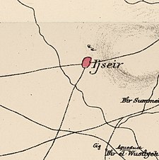
Jusayr 주변 지역의 일련의 역사 지도(버튼 클릭) | |
| 좌표:31°39°25°N 34°46°15°E/31.65694°N 34.77083°E좌표: 31°39°25°N 34°46°15°E / 31.65694°N 34.77083°E / | |
| 팔레스타인 그리드 | 128/118 |
| 지정학적 실체 | 필수 팔레스타인 |
| 소구 | 가자 |
| 인구 감소 연월일 | 1948년[4] 7월 17일~18일 |
| 지역 | |
| • 합계 | 12,361 dunams (122.361 km 또는 4.773 평방 mi) |
| 인구. (1945년) | |
| • 합계 | 1,180[2][3] |
| 인구 부족의 원인 | 이슈브군의 군사 공격 |
| 현재 지역 | 와돈[5] [5]주 |
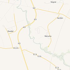
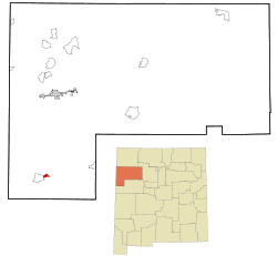
Jusayr는 가자 지구에 있는 팔레스타인 아랍 마을이었다.1948년 7월 17일 아랍-이스라엘 전쟁 중 바라크 작전 또는 요아브 작전으로 인구가 줄었다.그것은 가자에서 북동쪽으로 35km 떨어진 곳에 위치해 있었다.
역사
오스만 시대
1517년, 유사이르는 팔레스타인의 다른 지역과 함께 오스만 제국에 편입되었고, 1596년 이 마을은 가자의 리와 아래 가자의 나히야(하위 구역)에 있는 것으로 오스만 세금 등록부에 나타났다.인구 60명,[7] 추정 인구 [8]330명이었다.전체 인구가 [7]이슬람교도였다.밀, 보리, 여름 작물, 포도밭, 과수, 염소, 벌집, 그리고 "수시 수입"을 포함한 다수의 작물에 25%의 고정 세율을 지불했다. 총 12,180 아크체.[7]
1838년, 에드워드 로빈슨은 엘 주세이어를 [9][10]가자 지구에 위치한 무슬림 마을이라고 언급했다.
1863년 빅토르 게린은 500명의 주민이 [11]살고 있는 마을을 방문했고, 약 1870년의 오스만 마을 목록에는 총 119채의 주택에 296명의 인구가 살고 있는 것으로 나타났지만 인구 집계에 남자는 포함되어 [12][13]있었다.
1883년 PEF의 서부 팔레스타인 조사(SWP)는 평지에 [14]있는 어도비 마을이라고 묘사했다.
영국 위임 통치 시대
1922년 영국 위임통치국에 의해 실시된 팔레스타인 인구조사에서, 주사이르는 [15]모두 무슬림인 579명의 인구를 가지고 있었으며, 1931년 인구조사에서 [16]총 246채의 주택에서 839명의 무슬림으로 증가했다.
1945년 통계에 따르면, 공식 토지 및 인구 [3]조사에 따르면, 주사이르에는 총 12,361 두남의 땅이 있는 1180명의 [2]이슬람교도들이 살고 있었다.이 중,[17] 11,852 두남이 시리얼에 사용되었고 54 두남이 건설된 [18]땅이었다.
Jusayr는 1937년에 설립된 남자아이들을 위한 초등학교를 가지고 있었고, 1945년에는 [8]74명의 학생들이 있었다.
1948년 이후
1992년 마을 터는 다음과 같이 묘사되었다. "콘크리트, 평평한 지붕의 집은 여전히 복숭아 과수원 한가운데 서 있다.정면 정면에는 두 개의 직사각형 창문이 있고 가운데에는 직사각형 입구가 있다.키 큰 풀과 잡초 사이로 집들의 잔해가 보인다.현재 이스라엘 정착촌에 속하는 건물뿐만 아니라 쓰레기 처리장이 그 장소에 있다.주변 땅은 [5]경작되고 있다.
레퍼런스
- ^ 파머, 1881년, 페이지 368
- ^ a b 1945년 통계부, 페이지 31
- ^ a b c 팔레스타인 정부 통계국Village Statistics, 1945년 4월하다위에서 인용, 1970, 페이지 46
- ^ Morris, 2004년, p. xix, 마을번호 300번.또한 인구 감소의 원인이 됩니다.
- ^ a b c 칼리디, 1992, 페이지 118
- ^ 도팽, 1992, 873페이지
- ^ a b c 휘테로스와 압둘파타, 1977, 147페이지
- ^ a b 칼리디, 1992년, 페이지 117
- ^ 로빈슨과 스미스, 1841년, 제2권, 369쪽
- ^ 로빈슨과 스미스, 1841년, 제3권, 부록 2, 페이지 118
- ^ 게랭, 1869년, 페이지 122
- ^ 소신, 1879년, 페이지 153
- ^ Hartmann, 1883, 페이지 133은 또한 119 주택에 주목했다.
- ^ Conder and Kitchner, 1883, SWP III, 페이지 260, Kalidi에서 인용, 1992, 페이지 117
- ^ Barron, 1923, 가자 지구 서브 디스트릭트, 표 V, 9 페이지
- ^ 밀스, 1932, 페이지 4
- ^ 팔레스타인 정부 통계국Village Statistics, 1945년 4월하다위에서 인용, 1970, 87페이지
- ^ 팔레스타인 정부 통계국Village Statistics, 1945년 4월하다위에서 인용, 1970, 137페이지
참고 문헌
- Barron, J. B., ed. (1923). Palestine: Report and General Abstracts of the Census of 1922. Government of Palestine.
- Conder, C.R.; Kitchener, H.H. (1883). The Survey of Western Palestine: Memoirs of the Topography, Orography, Hydrography, and Archaeology. Vol. 3. London: Committee of the Palestine Exploration Fund.
- Dauphin, C. (1998). La Palestine byzantine, Peuplement et Populations. BAR International Series 726 (in French). Vol. III : Catalogue. Oxford: Archeopress. ISBN 0-860549-05-4.
- Department of Statistics (1945). Village Statistics, April, 1945. Government of Palestine.
- Guérin, V. (1869). Description Géographique Historique et Archéologique de la Palestine (in French). Vol. 1: Judee, pt. 2. Paris: L'Imprimerie Nationale.
- Hadawi, S. (1970). Village Statistics of 1945: A Classification of Land and Area ownership in Palestine. Palestine Liberation Organization Research Center.
- Hartmann, M. (1883). "Die Ortschaftenliste des Liwa Jerusalem in dem türkischen Staatskalender für Syrien auf das Jahr 1288 der Flucht (1871)". Zeitschrift des Deutschen Palästina-Vereins. 6: 102–149.
- Hütteroth, Wolf-Dieter; Abdulfattah, Kamal (1977). Historical Geography of Palestine, Transjordan and Southern Syria in the Late 16th Century. Erlanger Geographische Arbeiten, Sonderband 5. Erlangen, Germany: Vorstand der Fränkischen Geographischen Gesellschaft. ISBN 3-920405-41-2.
- Khalidi, W. (1992). All That Remains: The Palestinian Villages Occupied and Depopulated by Israel in 1948. Washington D.C.: Institute for Palestine Studies. ISBN 0-88728-224-5.
- Mills, E., ed. (1932). Census of Palestine 1931. Population of Villages, Towns and Administrative Areas. Jerusalem: Government of Palestine.
- Morris, B. (2004). The Birth of the Palestinian Refugee Problem Revisited. Cambridge University Press. ISBN 978-0-521-00967-6. (258-9페이지, 414)
- 나세르, G.A.(1955/1973): 팔레스타인 연구 저널의 "기억"
- '제1차 팔레스타인 전쟁의 추억' 제2회(73회) : 3-32], PDF 파일, 다운로드 가능
- Palmer, E.H. (1881). The Survey of Western Palestine: Arabic and English Name Lists Collected During the Survey by Lieutenants Conder and Kitchener, R. E. Transliterated and Explained by E.H. Palmer. Committee of the Palestine Exploration Fund.
- Robinson, E.; Smith, E. (1841). Biblical Researches in Palestine, Mount Sinai and Arabia Petraea: A Journal of Travels in the year 1838. Vol. 2. Boston: Crocker & Brewster.
- Robinson, E.; Smith, E. (1841). Biblical Researches in Palestine, Mount Sinai and Arabia Petraea: A Journal of Travels in the year 1838. Vol. 3. Boston: Crocker & Brewster.
- Socin, A. (1879). "Alphabetisches Verzeichniss von Ortschaften des Paschalik Jerusalem". Zeitschrift des Deutschen Palästina-Vereins. 2: 135–163.


