메스닐돔쿠르
Mesnil-Domqueur메스닐돔쿠르 | |
|---|---|
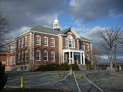
.JPG) 메스닐돔쿠르의 교회 | |
 국장 | |
메스닐돔쿠르의 위치  | |
 메스닐돔쿠르  메스닐돔쿠르 | |
| 좌표: 50°08′13″N 2°04′18″E / 50.1369°N 2.0717°E좌표: 50°08′13″N 2°04′18″E / 50.1369°N 2.0717°E/ | |
| 나라 | 프랑스. |
| 지역 | 오트드프랑스 |
| 부서 | 솜므 |
| 아르론디스먼트 | 아베빌 |
| 광동 | 루 |
| 인터커뮤니티티 | CC 폰티외마르퀴엔테르 |
| 정부 | |
| • 시장 (2020–2026) | 필리프 피에린[1] |
| 면적 1 | 3.49km2(1.35sq mi) |
| 인구 (2018년 1월)[2] | 89 |
| • 밀도 | 26/km2(66/sq mi) |
| 시간대 | UTC+01:00(CET) |
| • 여름(DST) | UTC+02:00(CEST) |
| INSEE/우편 번호 | 80537 /80620 |
| 표고 | 98–322 m(322–322 ft) (평균 122m 또는 400ft) |
| 1 1km2(0.386평방미터 또는 247에이커) 이하의 호수, 연못, 빙하 및 하천 유역을 제외한 프랑스 토지 등록부 자료. | |
메스닐돔쿠르(Mesnil-Domqueur)는 프랑스 북부 오트 드 프랑스에 있는 솜메(Somme) 부서의 코뮌이다.
지리
이 코뮌은 아브빌 북동쪽 약 17km(11mi)의 D130 도로에 위치해 있다. 이곳은 크래몬트, 돔쿠르, 돔레거-롱빌러로 둘러싸여 있다.[3]
인구
| 연도 | Pop. | ±% p.a. |
|---|---|---|
| 1968 | 86 | — |
| 1975 | 70 | −2.90% |
| 1982 | 81 | +2.11% |
| 1990 | 79 | −0.31% |
| 1999 | 57 | −3.56% |
| 2007 | 83 | +4.81% |
| 2012 | 87 | +0.95% |
| 2017 | 88 | +0.23% |
| 출처: INSEE[4] | ||
참고 항목
참조
- ^ "Répertoire national des élus: les maires". data.gouv.fr, Plateforme ouverte des données publiques françaises (in French). 2 December 2020.
- ^ "Populations légales 2018". The National Institute of Statistics and Economic Studies. 28 December 2020.
- ^ "애너와이어-마이리"
- ^ 역사 속의 인구 감소 1968, INSEEE
| 위키미디어 커먼즈에는 메스닐-돔큐어와 관련된 미디어가 있다. |