썰매미어
Sledmere| 썰매미어 | |
|---|---|
 썰매미어 오두막 | |
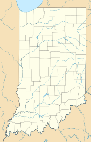
 썰매미어 요크셔 동부 라이딩 내 위치 | |
| OS 그리드 참조 | SE932648 |
| 시민 교구 |
|
| 유니터리 권한 | |
| 의례군 | |
| 지역 | |
| 나라 | 잉글랜드 |
| 소버린 주 | 영국 |
| 포스트타운 | 드리필드 |
| 우편 번호 구 | YO25 |
| 디알링 코드 | 01377 |
| 경찰 | 험버사이드 |
| 불 | 험버사이드 |
| 구급차 | 요크셔 주 |
| 영국 의회 | |

썰매미어는 영국 요크셔의 이스트 라이딩(East Rideing)에 있는 마을로, B1253 도로의 드리필드에서 북서쪽으로 약 11km 떨어진 곳에 있다.
이 마을은 공식적으로 "슬레드미어"라고도 불리는 시민 교구에 위치하고 있는데,[1] 비록 카운티 의회와 교구의회가 이를 썰매미어, 크로옴이라고 부르지만, 그 교구에는 근처 크롬의 햄릿도 포함되어 있기 때문이다. 2011년 영국 인구조사에 따르면,[2] 교구의 인구는 377명으로 2001년 영국 인구조사 수치인 197명보다 증가했으며, 교구의 면적은 2,849헥타르(7,040에이커)이다.[3][4]
지역 랜드마크
현지 관심 포인트로는 그루지야 시골집인 썰매미어 하우스 등이 있다. 1751년 리처드 사이크스(Richard Sykes)에 의해 지어진 이 집은 이후 사이크스 가문에 남아 있다. 지금은 8대 남작 타튼 사이크스 경의 집이다.
썰매미어 기념비는 가튼 힐 정상의 B1252 도로를 따라 마을에서 남동쪽으로 약 3km 떨어진 곳에 있다. 높이는 120피트(37m)로 1865년 친구들이 지은 4대 남작 타튼 사이크스 경을 기리는 곳이다.
제6대 남작 마크 사이크스 경이 디자인한 마을 마차 기념관은 1차 세계대전에서 싸우기 위해 마크 경이 지역 인구로부터 길러낸 군단인 월즈 마차너즈 보호구역에 헌납하고 있다. 특이한 모양과 전쟁과 시골 생활의 그래픽적인 장면으로 유명하다. 기념관은 1966년 9월 2급 상장 건물로 지정됐다가 2016년 3월 1급으로 격상됐다.[5]
썰매미어는 1966년 9월 2급 상장건물로 지정했다가 2016년 3월 1급으로 격상된 복제품 엘레노어 십자가, 썰매미어([6]Eleanor Cross, Sledmere)의 현장이기도 하다.

The 'Sledmere Cross' takes the form of an Eleanor Cross and is a true 'folly' that was 'converted' in 1919 to a War Memorial by Sir Mark Sykes (of the Sykes–Picot Agreement) who added a series of brass portraits in commemoration of his friends and the local men who fell in the war and also notably himself in crusader armour with the inscription “La에타레 예루살렘 (Rejoice 예루살렘)."
마을 동쪽에 있는 썰매미어 성은 제2대 남작 크리스토퍼 사이크스 경을 위해 1790년경 존 카가 썰매미어 하우스에서 경치를 높이기 위해 지은 어리석음이다.
성 마리아 교회는 사이크스 교회 산책로에 있는 교회들 중 하나이다.[7] 1966년 교회는 2급* 상장 건물로 지정되었다.[8]
썰매미어는 1853년에서 1950년 사이에 말톤과 드리필드 철도의 썰매미어와 핌버 기차역에서 운행되었다.[9]
썰매미어의 이미지
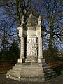
Wolds Waganers Reserve 전쟁 기념비

썰매미어 성

썰매미어 하우스
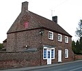
정육점


참조
- ^ "Sledmore". Office for National Statistics. Retrieved 29 September 2017.
- ^ "Key Figures for 2011 Census: Key Statistics: Area: Sledmere CP (Parish)". Neighbourhood Statistics. Office for National Statistics. Retrieved 4 February 2013.
Note the ONS map appears to show combined with Fimber parish so figure may include that parish which is under the 100 threshold for statistical output.
- ^ "2001 Census: Key Statistics: Parish Headcounts: Area: Sledmere CP (Parish)". Neighbourhood Statistics. Office for National Statistics. Retrieved 12 March 2008.
- ^ "2001 Census Area Profile" (PDF). East Riding of Yorkshire Council. 2004. Archived (PDF) from the original on 18 March 2012. Retrieved 8 February 2013.
- ^ Historic England. "Wagoners' Memorial (1161354)". National Heritage List for England. Retrieved 24 March 2016.
- ^ Historic England. "Eleanor cross (1083806)". National Heritage List for England. Retrieved 24 March 2016.
- ^ "Sykes Churches Trail Southern Route". Beverley, East Yorkshire: East Yorkshire Historic Churches Group.
- ^ Historic England. "Church of St Mary (1310183)". National Heritage List for England. Retrieved 27 June 2013.
- ^ Butt, R. V. J. (1995). The Directory of Railway Stations: details every public and private passenger station, halt, platform and stopping place, past and present (1st ed.). Sparkford: Patrick Stephens Ltd. ISBN 978-1-85260-508-7. OCLC 60251199.
- Gazetteer — A–Z of Towns Villages and Hamlets. East Riding of Yorkshire Council. 2006. p. 10.
외부 링크
![]() 위키미디어 커먼스의 썰매미어 관련 매체
위키미디어 커먼스의 썰매미어 관련 매체
- 돔스데이 책의 썰매미어
- 요크셔 월즈 빌리지
- 썰매모어 부동산 서류 - 헐 대학교
- 요크셔 월즈 왜거너스.
- [1] - Melvyn Bragg가 Wolds Wagnerers에 대해 제공하는 라디오4 프로그램.