교살로웨이 분화구
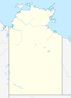
Strangways crater교살로는 큰 충격 구조물로, 이전 충격 분화구의 침식된 잔해로, 마타란카 마을에서 남동쪽으로 약 65킬로미터(40mi) 떨어진 오스트레일리아 북부 영토에 위치해 있다.[1][2] 그것은 근처의 스트링웨이즈 강의 이름을 따서 지어졌다. 그 위치는 멀리 떨어져 있어서 접근하기 어렵다. 그것의 나이는 대략 646 Ma로 결정되었다.
설명
그 부지를 표시하는 원형 지형적 특징은 원래 화산인 것으로 생각되었는데, 파쇄 원뿔과 충격 석영 등 충격에 대한 증거 진단 결과가 발견된 1971년에 충격 원점이 처음 제안되었다.[3] 원형 지형적 특징은 지름 약 16km(9.9mi)이며 맥아더 분지의 중생대 퇴적암 안에 있다. 그러나 이것은 상당한 침식 후 원래의 분화구의 유물에 불과하다. 원래 림 직경의 추정치는 24–40 km(15–25 mi) 범위에서 서로 다른 연구자들 사이에 다양하며,[4] Earth Impact Database는[1] 25 km(16 mi)의 직경을 선호한다. 충격 녹는 암석의 방사선학적 연대를 기준으로 충격 사건의 연령이 646 ± 42 Ma(신경생성)로 결정되었다.[5]
1996년 이 분화구의 부지는 지금은 없어진 국유지에 등재되었다.[2]
참고 항목
참조
- ^ Jump up to: a b "Strangways". Earth Impact Database. Planetary and Space Science Centre University of New Brunswick Fredericton. Retrieved 2017-10-09.
- ^ Jump up to: a b "Strangways Crater, Mataranka,(sic) NT, Australia - listing on the now-defunct Register of the National Estate (Place ID 18094)". Australian Heritage Database. Department of the Environment. 28 May 1996. Retrieved 7 April 2020.
- ^ Guppy DJ, Brett R, Milton DJ (1971). "Liverpool and Strangways craters, Northern Territory; two structures of probable impact origin". Journal of Geophysical Research. 76 (23): 5387–93. Bibcode:1971JGR....76.5387G. doi:10.1029/JB076i023p05387.
- ^ Haines PW (2005). "Impact cratering and distal ejecta: the Australian record". Australian Journal of Earth Sciences. 52 (4–5): 481–507. Bibcode:2005AuJES..52..481H. doi:10.1080/08120090500170351. S2CID 128705406. 추상적[영구적 데드링크]
- ^ Spray JG, Kelley SP, Dence MR (1999). "The Strangways impact structure, Northern Territory, Australia: geological setting and laser probe 40Ar/39Ar geochronology". Earth and Planetary Science Letters. 172 (3–4): 199–211. Bibcode:1999E&PSL.172..199S. doi:10.1016/S0012-821X(99)00206-X. 추상적


