가론느
Garonne본 기사는 해당 기사에서 프랑스어로 번역된 텍스트로 확장될 수 있다.(2014년 7월) 중요한 번역 지침은 [표시]를 클릭한다.
|
| 가론느 | |
|---|---|
 보르도의 가론 | |
 가론 지도 | |
| 네이티브 이름 | 가로나 (오크시탄) |
| 위치 | |
| 나라들. | 프랑스와 스페인 |
| 물리적 특성 | |
| 출처 | |
| • 위치 | 피레네 |
| • 좌표 | 42°36′26″N 0°57′56″E/42.607295°N 0.965424°E |
| • 고도 | 2,600m(8,500ft) |
| 입 | |
• 위치 | 지롱드 하구, 대서양 |
• 좌표 | 45°2′29″N 0°36′24″w/45.04139°N 0.60667°W좌표: 45°2′29″N 0°36′24″W / 45.04139°N 0.60667°W/ |
| 길이 | 529km(329mi) |
| 분지크기 | 56,000km2(2만 2천 제곱 미) 또는 도르도뉴 포함: 84,811km2(32,746 제곱 미) |
| 방전 | |
| • 평균 | 650m3/s(23,000cu ft/s) |
가론느(/ɡəˈrnn, æˈ--, 또한 미국: /ɑːˈˈrrnn/, 프랑스어: [ɡaʁn];오시탄, 카탈루냐, 바스크, 스페인어: 가루나, 서양어: [ɡaˈɾunun, ɡaˈɾnɔ], 라틴어: 가루나[1][2] 또는 가루나)는 프랑스 남서부와 스페인 북부의 강이다.스페인 중부 피레네에서 프랑스 보르도의 지롱드 하구까지 흐른다. 이 중 길이 529km(329mi)[3]는 스페인(발다란)에 있으며,[4] 강과 바다 사이에 지롱드 하구까지 포함하면 총 길이는 602km(374mi)에 이른다.분지 면적은 5만6000km2(2만2000mi)로,[4] 동쪽에서 흘러 베크담베스에서 가론 강과 합류해 지론데 하구를 형성하는 도르도뉴 강이 포함되면 8만4811km2(3만2746mi)로 늘어난다.
우마야드와 아키타니아군은 732년 현재의 보르도 인근 강가에서 가론 강 전투와 싸웠다.
어원
이 이름은 "stony river"("stony river"와 "-ona"와 "stone"과 "-ona"와 "stone"을 뜻하는 아키타니아어 이름의 라틴어 버전인 Garumna에서 유래되었다.
지리
원천


The Garonne's headwaters are to be found in the Aran Valley in the Spanish Pyrenees, though three different locations have been proposed as the true source: the Uelh deth Garona at Plan de Beret (42°42′34″N 0°56′43″E / 42.709494°N 0.945398°E), the Ratera-Saboredo cirque 42°36′26″N 0°57′56″E / 42.607295°N 0.965424°E/ 0) 또는 Pic Aneto(Salterillo-Barrancs ravine 42°3).8′59″N 0°40′06″E / 42.6498°N 0.6683°E/ 계절에 0).
해발 1862m(6109ft)의 우엘 데트 가로나호는 전통적으로 가론호의 발원지로 여겨져 왔다.이때부터 개울(베레트로나라고 불림)은 2.5km(1.6mi)로 주 상층 가론 계곡의 침상까지 달린다.퐁 드 레이에서 프랑스 국경까지 총 40.5km(25.2mi)의 강물이 38km(24mi) 더 흐른다.
The Ratera-Saboredo cirque is the head of the upper Garonne valley, and its upper lake at 2,600 metres (8,500 ft) above sea level is the origin of the Ruda-Garona river, running for 16 kilometres (9.9 mi) until the confluence with the Beret-Garona brook, and another 38 kilometres (24 mi) until the French border at Pont del Rei, 54 kilometres (34 mi) 총합해서.혼합물에서 루다-가로나는 초당 2.6 입방미터(92 cu ft/s)의 물을 운반한다.[5][6]라테라-사보레도 서크는 많은 연구자들에 의해 가론의 기원으로 지목되어 왔다.[7][8][9][10]
The third thesis holds that the river rises on the slopes of Pic Aneto at 2,300 metres (7,500 ft) above sea level and flows by way of a sinkhole known as the Forau de Aigualluts (42°40′00″N 0°40′01″E / 42.6666°N 0.6669°E) through the limestone of the Tuca Blanca de Pomèro and a resurgence in the Val dera Artiga above the Aran Vall스페인 피레네에 있는 아이.[11]This underground route was suggested by the geologist Ramond de Carbonnières in 1787, but there was no confirmation until 1931, when caver Norbert Casteret poured fluorescein dye into the flow and noted its emergence a few hours later 4 kilometres (2.5 mi) away at Uelhs deth Joèu ("Jove's eyes" 42°40′51″N 0°42′28″E / 42.68092°N 0.7077°E[12][13][14] ) 산 반대편의 아르티가 데 린에서.From Aigualluts to the confluence with the main river at the bed of the upper Garonne valley at 800 metres (2,600 ft) above sea level, the Joèu has run for 12.4 kilometres (7.7 mi) (16 kilometres more to get to the French border), carrying 2.16 cubic metres per second (76 cu ft/s) of water, while the main river is carrying 17.7 cubic metres per se콘드(cond cu ft/s).[5][6][15]
미국 지질조사국, 내셔널지오그래픽협회, 스미스소니언 협회는 하천의 원천을 (하천 하구의 수원과 함께) 가장 먼 곳으로 간주해야 한다는 데 의견을 같이한다.달리다[16][17][18][19][20]
미국 지질조사국, 미국지리학협회, 스미스소니언 협회에 따르면 라테라-사보레도 서크는 "물이 흐르는 배수 유역에서 가장 먼 지점(강 어귀에서 나온 물방울과 함께)"[21][22]이며, 가론 강의 원천이다.
코스
가론네는 북쪽의 아란계곡을 따라 프랑스로 들어가 툴루즈와 아겐을 거쳐 보르도 쪽으로 흐르며 그곳에서 지롱드 하구와 만난다.지론드는 대서양(Bay of Biscay)으로 흐른다.그 진로를 따라 가론 강에는 아리에게 강, 타른 강, 롯 강 등 3개의 주요 강이 합류한다.보르도 직후 가론족은 베크담베스에서 도르도뉴 강을 만나 약 100km(62mi)가 지나 대서양으로 흘러들어가는 지롱드 하구를 형성한다.다른 지류로는 세이브와 게르스가 있다.
가론강은 조수간만의 강이다.[23][24][25]서퍼들과 제트 스키어들은 적어도 대서양에서 120킬로미터(75mi) 떨어진 캄베 마을까지 조수를 탈 수 있었고, 심지어 캐딜락까지 상류까지 조수가 나타나서 채널 욕조의 변화에 따라 사라지긴 하지만 조수를 탈 수 있다.2010년과 2012년에는 아르킨스 섬과 라스트레네 읍내에 가까운 우측 은행 사이의 가론스 아킨스 채널에서 몇 가지 상세한 현장 연구가 실시되었다.[23]현장 데이터 세트의 두드러진 특징은 조수와 홍수 흐름 동안 난류 속도와 난류 응력의 크고 빠른 변동이었다.[24][25][26]
유럽의 철갑상어 보존

대서양 철갑상어 또는 일반 철갑상어라고도 알려진 유럽 철갑상어(Acipenser sturio)는 현재 멸종위기종(IUCN) 지위가![]() 되었다.[27]이 철갑상어의 종은 길이가 6m(20ft), 무게는 최대 400kg(880lb)에 달하며 100세에 이를 수 있다.[28]이전에 유럽의 대부분의 해안에서 발견되었던, 지금은 프랑스의 가론 강 유역에서만 번식할 정도로 매우 희귀해졌다.[27]양식업에서 종 재도입을 통해 이 물고기를 멸종으로부터 구하기 위한 보존 프로젝트가 진행 중이며, 1995년에 첫 방류가 이루어졌다.[27]
되었다.[27]이 철갑상어의 종은 길이가 6m(20ft), 무게는 최대 400kg(880lb)에 달하며 100세에 이를 수 있다.[28]이전에 유럽의 대부분의 해안에서 발견되었던, 지금은 프랑스의 가론 강 유역에서만 번식할 정도로 매우 희귀해졌다.[27]양식업에서 종 재도입을 통해 이 물고기를 멸종으로부터 구하기 위한 보존 프로젝트가 진행 중이며, 1995년에 첫 방류가 이루어졌다.[27]

강가의 도시들
- 아란 계곡(스페인):비엘하, 보쉬스트
- 오뜨가론(31) : 생가우덴스, 무레트, 툴루즈
- 타른에가론(82): 카스텔사라신
- 롯에가론(47) : 아겐, 마만데, 아이구이론
- 지롱드(33): 랭곤, 보르도
주요 지류
강물의 흐름을 따라 원천에서 입으로:
가론호는 내륙 해운에서 중요한 역할을 한다.이 강은 세고 있는 선박들이 보르도 항에 도착할 수 있을 뿐만 아니라 지중해와 대서양을 연결하는 운하 데 듀스 메르스의 일부를 형성한다.
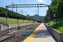
.JPG)
바다로부터 기론데 하구를 지나 가론느( 상류로 항해할 때 도르도뉴의 오른쪽) 어귀까지 배들이 지나간다.보르도 퐁 드 피에르(돌다리)까지 조수 가론 강에서 배들이 이어진다.내륙의 선박들은 카스테트-엔-도르테까지 상류로 계속되는데, 여기서 운하 드 가론호가 강과 합류한다.1838년에서 1856년 사이에 운하 측측면 라 가론느를 건설하기 전에, 얕은 습격을 받은 배들은 툴루즈까지 가론 그 자체를 이용했다.그러나, 상류의 강에서의 항해는 매우 불확실했고, 이 강의 연장선은 더 이상 항해할 수 있는 것으로 여겨지지 않는다.대신 횡운하는 53개의 자물쇠를 통해 운하와 미디 운하가 만나는 툴루즈 마을로 배를 가져간다.[29]
하이드로그래피
툴루즈에서 상류로 올라가는 강의 상류 부분은 주로 눈과 눈이 녹는 것에 의존한다.하류/하류 지역은 주요 지류뿐만 아니라 비 공급 지역이다.
Garonne은 또한 다음과 같은 여러 채널/운하를 공급한다.
SANDRE는 Garonne에 0 -- 00000이라는 수로 식별 번호와 일반 코드 O -- 000014,15를 할당한다.
홍수
툴루즈에서 2022년 1월 홍수.

1930년 가론강의 홍수로 티브라스(마르만데)의 둑이 무너졌다.
툴루즈에서는 특히 왼쪽 둑이 사람이 살고 있기 때문에 가론느가 많은 홍수의 원인이 되어 왔다.
홍수에 대한 가장 초기 기록은 약 1177년부터이다.또한 1220년, 1258년, 1430년, 1523년, 1536년, 1589년, 1608년, 1658년, 1673년, 1675년, 1709년, 1712년, 1750년, 1772년, 1788년, 1804년, 1810년에 침수되었다고 기록되어 있다.1772년에 가론호는 8미터 50에 달했다.[31]최근 몇 세기 동안, 1827년, 1835년, 1855년, 1856년/7년.
툴루즈에서는 1827년 가론 강의 수위가 보통 수위보다 4m 높아져 퐁 드 피에르와 퐁뇌프의 아치를 채웠다.
1835년 가론네는 평년보다 5m, 낮은 수위보다 35m 높이까지 솟아올라 퐁 드 피에르(Pont de Pierre)의 네 호를 통해 흘러갔다.
1835년 가론호의 홍수: 툴루즈 퐁뉴프에서 7,50m
1855년 가론호의 홍수: 툴루즈 퐁뉴프에서 7.25m
1875년 가론의 홍수: 9,70m에서 툴루즈 퐁뇌프(또는 비지크루에 따르면 8m32).
1879년 가론호의 홍수: 툴루즈 퐁뉴프에서 4,87m
1890년 가론호의 홍수: 툴루즈 퐁뉴프에서 3.30m
1900년 가론호의 홍수: 툴루즈 퐁네우프의 4,00m
1905년 가론호의 홍수: 툴루즈 퐁뉴프에서 4.24m
1927년 아퀴타인에 있는 크레타, 특히 가론 강과 롯(그 중 원시 기준)이 합친 후에 위압적인, 대수롭지 않은 업스트림 18.
1952년 가론호의 홍수: 툴루즈 퐁뉴프에서 4,57m
1977년 가론호 홍수: 툴루즈 퐁뉴프에서 4,31m
2000년 가론호 홍수: 툴루즈 퐁뉴프에서 4.38m
2004년 가론호 홍수: 툴루즈 퐁뉴프에서 3,52m
1777년, 가론네는 그 해의 행위가 끝날 무렵 세례, 결혼, 사망 등의 교구 명부에 그 사건을 재전송하기 위해 애를 쓸 정도로 엄청난 홍수를 겪었다.
참고 항목
참조
- ^ Smith, William (1850). A new classical dictionary of Greek and Roman biography, mythology, and geography. London: John Murray. p. 492. OCLC 223027795.
- ^ Smith, William (1862). "GARUMNA". In Anthon, Charles (ed.). A New Classical Dictionary of Greek and Roman Biography, Mythology and Geography, partly based upon the Dictionary of Greek and Roman Biography and Mythology by William Smith [...]. Revised by Charles Anthon (revised ed.). New York: Harper (published 1895). p. 322. Retrieved 14 December 2019.
GARUMNA (now Garonne), one of the chief rivers of Gaul, rises in the Pyrenees, flows northwest through Aquitania, and becomes a bay of the sea below Burdigala (now Bordeaux).
- ^ Sandre. "Fiche cours d'eau - La Garonne (O---0000)".
- ^ a b 르 바신 베르상트 드 라 가론, 신디카트 믹스테 드 데투데스 & 다메네지먼트 드 라 가론
- ^ a b "3". oph.chebro.es. Archived from the original on 14 March 2012.
- ^ a b [1]
- ^ Salvador Rivas-Martínez (member of the Spanish Royal Academy of Sciences); Manuel Costa (Professor of the Universitat de Valencia) (1998). "Datos sobre la vegetación y bioclima del Valle de Arán". Acta Bot. Barcinon. 45: 473–499.
- ^ 솔러 이 산탈로; 라 발 다르란.구아 모노그라피카 데 라 코마르카; 12 페이지1916년 바르셀로나
- ^ Faura i Sans (M.; Los Pirios Centrales de Aragon y Cataluena); Sobre hiddogitoria subteraraha in los Pirios Centrales de Aragon y Cataluena.Bol. de la Real Soc. de Hist.낫, 토해, 16세, 피그 353-3541916년 마드리드
- ^ "Boletín del Centro Excursionista de Cataluña".
- ^ Reynolds, Kev (2001). Walks and Climbs in the Pyrenees. Milnthorpe, England: Cicerone Press. p. 208. ISBN 978-1-85284-328-1.
- ^ Casteret, Norbert (1939). Ten Years Under the Earth. Mussey, Barrows (trans). London: J. M. Dent.
- ^ Mapa topogràfic de Catalunya 1:100 000 (Map) (1st ed.). Institut Cartogràfic de Catalunya. § 1: Pirineu occidental.
- ^ Lambert, Roger (1996). "A propos de la Garonne Supérieure". Géographie du cycle de l'eau (in French). Toulouse: Presses Universitaires du Mirail. p. 351. ISBN 978-2-85816-273-4.
prouvant péremptoirement que la Garonne a sa vrai source et la plus importante dans les Monts Maudits, sur le versant Sud des Pyrénées ('proving conclusively that the Garonne has its true source, and the most important, in the Monts Maudits, on the southern slopes of the Pyrenees')
- ^ "Archived copy". Archived from the original on 17 November 2010. Retrieved 11 January 2011.
{{cite web}}: CS1 maint: 타이틀로 보관된 사본(링크) - ^ "Largest Rivers in the United States" (PDF). United States Geological Survey. Retrieved 24 October 2009.
- ^ "National Geographic News @ nationalgeographic.com".
- ^ "The True Utmost Reaches of the Missouri".
- ^ "IBGE - Instituto Brasileiro de Geografia e Estatística". Archived from the original on 28 September 2008. Retrieved 24 December 2019.
- ^ "Quest for the Missouri River Source, John LaRandeau, U.S. Army Corps of Engineers" (PDF). Archived from the original (PDF) on 2 June 2013. Retrieved 11 January 2011.
- ^ Instituto Geográfico Nacional; Ministerio de FOmento. "Visor cartográfico del Instituto Geográfico Nacional". Instituto Geográfico Nacional de España. Retrieved 10 November 2012.
- ^ s - Géoportail, le portail des territoires et des citoyens. "IGN France Cartes Topographie". Retrieved 10 November 2012.
- ^ a b Chanson, H., Lubin, P., Simon, B., and Reungoat, D. (2010). Turbulence and Sediment Processes in the Tidal Bore of the Garonne River: First Observations. Hydraulic Model Report No. CH79/10, School of Civil Engineering, The University of Queensland, Brisbane, Australia, 97 pages. ISBN 978-1-74272-010-4.
{{cite book}}: CS1 maint : 복수이름 : 작성자 목록(링크) - ^ a b Simon, B., Lubin, P., Reungoat, D., Chanson, H. (2011). Turbulence Measurements in the Garonne River Tidal Bore: First Observations. Proc. 34th IAHR World Congress, Brisbane, Australia, 26 June – 1 July, Engineers Australia Publication, Eric Valentine, Colin Apelt, James Ball, Hubert Chanson, Ron Cox, Rob Ettema, George Kuczera, Martin Lambert, Bruce Melville and Jane Sargison Editors. pp. 1141–1148. ISBN 978-0-85825-868-6.
{{cite book}}: CS1 maint : 복수이름 : 작성자 목록(링크) - ^ a b Chanson, Hubert; Reungoat, David; Simon, Bruno; Lubin, Pierre (December 2011). "High-frequency turbulence and suspended sediment concentration measurements in the Garonne River tidal bore". Estuarine, Coastal and Shelf Science. 95 (2–3): 298–306. Bibcode:2011ECSS...95..298C. CiteSeerX 10.1.1.692.2537. doi:10.1016/j.ecss.2011.09.012.
- ^ Reungoat, D., Chanson, H., Caplain, B. (2012). Field Measurements in the Tidal Bore of the Garonne River at Arcins (June 2012). Hydraulic Model Report No. CH89/12, School of Civil Engineering, the University of Queensland, Brisbane, Australia, 121 Pages. ISBN 9781742720616.
{{cite book}}: CS1 maint : 복수이름 : 작성자 목록(링크) - ^ a b c Gesner, J.; Williot, P.; Rochard, E.; Freyhof, J.; Kottelat, M. (2010). "Acipenser sturio". IUCN Red List of Threatened Species. 2010: e.T230A13040963. doi:10.2305/IUCN.UK.2010-1.RLTS.T230A13040963.en.
- ^ 프루즈, 레이너; 파울리, 다니엘 (에드) (2005)피쉬베이스의 "아시펜서 스터리오" 2005년 버전 10.
- ^ Rolt, L. T. C. (1973). From Sea to Sea: An Illustrated History of the Canal du Midi. Grenoble, France: Euromapping. pp. 19–40. ISBN 978-2-910185-02-2.
- ^ "Garonne Irrigation channels". Archived from the original on 4 December 2008. Retrieved 13 August 2018.
- ^ Astrié, Théophile (1875). Les drames de l'inondation à Toulouse / Théophile Astrié Éditeur : Éditeur : Librairie centrale (Toulouse) Date d'édition : 1875 gallica.bnf.fr/ark:/12148/bpt6k5778575j. Librairie centrale (Toulouse): Arnaud et Labat (Paris).
외부 링크
- 프랑스 내륙 수로 저자 임레이가 운하의 장소, 항구, 계류지 등에 대한 자세한 정보를 가론느와 지론데 하구(Gironde Houghard)가 전했다.
- 80개 프랑스 하천 및 운하에 대한 항해 세부 정보(프랑스 수로 웹사이트 섹션)
- 가론 강과 주요 지류의 역사와 실시간 수위