미시간 주의 미국 고속도로 목록
List of U.S. Highways in Michigan| 미국, 주 간선 고속도로 시스템 번호 부여 | |
|---|---|
   구 미국 고속도로 102 (1926), 구 미국 고속도로 16 (1948), 현재 미국 고속도로 23 (1973)의 다른 연도의 고속도로 표지 | |
 빨간색으로 강조된 미시간 주의 미국 고속도로 | |
| 시스템 정보 | |
| MDOT에 의해 유지 관리 | |
| 길이 | 2,1973.653 mi[3](3,700.933km) + 159.621mi(256.885km)의 비즈니스 경로 |
| 형성된 | 1926년 11월 11일 ([1][2] |
| 고속도로명 | |
| 미국 고속도로 | 미국 고속도로 nn(미국 nn) |
| 특수 경로: |
|
| 시스템 링크 | |
미시간 주의 미국 고속도로는 미시간 주가 소유하고 관리하는 미국 번호 고속도로 시스템의[4] 구간으로 총 2,300마일(3,701km)이다.[5][3]이 중 가장 긴 것은 약 583km(362마일)의 미국 고속도로 23호선이다.국가 차원에서 이 제도의 기준과 번호 매기기는 미국도로교통관리협회(AASHTO)가 담당하고, 미시간 주의 고속도로는 미시간 교통부(MDOT)가 관리하고 있다.
원래의 고속도로는 1926년 11월 11일에 AASHTO에 의해 14개의 간선 고속도로를 포함하여 승인되었다.이러한 원래의 고속도로 지정들 중 몇 개는 더 이상 미시간 주 내에서 운영되지 않으며, 1930년대 이후 몇 개의 숫자가 추가되었다.1999년 이후 13개의 간선도로가 개설되었으며, 콘스탄티누스 사업노선이 신설되면서 주에는 총 30개의 특별노선이 개설되었다.몇몇 고속도로가 고속도로로 전환되었는데, 그 중 일부는 현재 주간 고속도로로, 더 이상 미국 고속도로 시스템의 일부가 아니다.이러한 고속도로 전환은 1940년대와 1950년대에 시작되어 21세기까지 계속되었다.
설명
MDOT는 미시간 주의 미국 고속도로를 포함하는 주 간선 고속도로 시스템의 일상적인 유지·운영을 담당하는 기관이다.이들 고속도로의 번호 매기는 미국의 다양한 주 교통부로 구성된 기구인 [6]AASHTO를 통해 조정된다.[7]1926년에 확정된 계획에 따르면, 미국 고속도로는 두 자리 수의 번호가 격자로 표시되며, 동서 간 고속도로는 짝수인 반면 남북 간 노선은 홀수인 것으로 나타났다.가장 낮은 숫자는 동쪽과 북쪽이다.미시건 주의 동서 간 고속도로는 20대 초반까지 한 자릿수를 기록하고 있다.남북 간 고속도로는 20대부터 40대까지 다양하다.관련 두 자릿수 고속도로 분기점으로는 100대 세 자리, 200대 한 자리도 있다.[8]
미시간 주에서는 미국 고속도로가 약 2,300마일(3,701km)의 간선도로와 또 다른 160마일(257km)의 특별노선에 걸쳐 있다.[3]미서명 사업 노선 1개를 포함해 모두 13개의 간선 고속도로와 30개의 특별노선이 있다.[8][9]상반도의 간선 고속도로 중 2개가 주를 빠져나와 다시 진입하여 미시건에서 각각 2개의 고속도로 구간이 불연속적으로 분할된다.[10]주 내에서 가장 긴 미국 고속도로는 오하이오 주 북부 노선에서 하반도의 맥키낙 해협까지 362마일(583km)이 조금 넘는 미 고속도로 23번(US 23)이며, 가장 짧은 구간은 디킨슨 카운티의 노르웨이 남부 8번지 중 2.3마일(3.7km) 구간이다.특수 경로의 길이 범위는 약비즈니스 US 2(2.0km)의 경우 1+1⁄4 마일(2.0km)버스의 경우 16km(10마일)까지 Ironwood에 있는 US 2) Kalamazoo에 있는 US 131 입니다.[3]
역사

미국 고속도로 시스템은 1926년 11월 11일에 승인되었다.[1]당시 미시간주에는 14개의 간선도로가 지정됐다.[2]2년 안에, 연장된 US 141의 일부로 US 102의 번호가 다시 매겨졌고, 이전의 지명은 해제되었다.[11]그 이후로, 1930년대에 주에서는 또 다른 네 개의 지정이 추가되었다.그 중 하나로 US 112S는 미국 112 메인라인의 접미사가 붙은 방향지점으로, 1931년에 지정된 지 몇[12] 년 후에 제거되었다.[13]같은 기간, 첫 번째 대체 경로가 지정되었고, "A" 접미사가 붙은 번호가 붙었다.[a]
제2차 세계대전 당시 미시간 주 고속도로국([b]MSHD)은 노동자들을 디트로이트에서 윌로우런 공항의 방공공장까지 실어 나르기 위해 윌로우런 고속도로를 건설했다.[19]이 고속도로는 처음에 미국 112의 일부로 등록되었다.[20]1950년대에는 1957년 주간 고속도로가 생기기 전에 고속도로가 추가로 고속도로로 전환되었다.주간 고속도로로 번호를 매긴 첫 번째 고속도로는 1959년에 75번 주간 고속도로(I-75)의 일부가 된 주의 남동쪽 구석에 있는 US 24A였다.[21]
1960년대 미시간주가 인터스테이트의 완공과 함께 미국 고속도로를 은퇴하거나 재통행하면서 번호에 큰 변화가 시작되었다.1962년 I-94가 원래의 미국 12를 대체하면서 US 12는 US 112를 대체했고,[22] 그해 말, US 16은 I-96을 위해 해체되었다.[23]이러한 경향은 1970년대까지 계속되었는데, 그 당시 US 25는 I-75와 I-94의 구역에 중복으로 해체되었다.[24]
기존 미국 고속도로의 모든 고속도로 전환이 미국 고속도로 번호를 삭제하는 결과를 가져온 것은 아니다.1968년, 주 정부는 미국 131번 도로 전환 제안서를 포함한 추가 주간 고속도로 주행 거리 요청서를 연방 정부에 제출했다.[25]이[26] 구체적인 사업은 1970년대와 1980년대에 개통된 다양한 구간을 포함해 국가가 고속도로 전환을 위한 자체 노력을 계속했지만 승인되지 않았다.[27]고속도로로 전환된 다른 고속도로에는 US 10, US 23, US 27, US 31, US 127이 포함되었다.[8]
1970년대 말, MDOT는 연방 고속도로 관리청이 지원하는 포지티브 가이드 데모 프로젝트라는 이니셔티브에 참여했고, 두 기관은 그랜드 래피즈 북부의 워커에서 I-96/M-37과 I-296/US 131 인터체인지 주변의 시그니지 관행을 감사했다.MDOT는 I-296 지정의 사용이 "자동차 운전자들에게 잠재적인 혼란의 원인"이라고 결정했다.[28]이 프로그램에 이어, MDOT의 반사 시스템 유닛은 미시간 주의 고속도로 시스템을 따라 2방향 및 3방향 동시화폐의 상태를 검토했다.그들은 1982년 10월 19일 부서 간선번호 부여위원회와 구 교통안전기술자들에게 "운전자의 혼란을 피하고 자금을 절약"하기 위해 다양한 중복 지정을 줄이거나 없애자는 제안을 하기 위해 접근했다.[29]초기 토론 보고서에는 주간 고속도로와 미국 고속도로 사이에 남아 있는 여러 가지 중복 사항이 포함되었다.[29]1983년 3월 17일 부대가 최종 권고안을 발표했을 때, 다양한 변화가 제안되었다.[30]1983년에는 US 2가 잘려 I-75와 중첩이 제거되었고,[31] 1986년에는 US 10이 비슷하게 단축되어 I-75와 중첩이 제거되었다.[32]US 33은 1986년 주에서도 거의 없어져 US 31과의 중첩이 없어졌다.[33] 10년 후, 1990년대에는 US 33과 US 27이 각각 1997년과[34] 1999년에 끝나기 위해 잘려나가면서 두 개의 고속도로 지정이 주에서 완전히 제거되었다.[35]후자는 또한 I-69와의 중첩을 제거했다.[36]
21세기 경에는 추가적인 고속도로 구간이 개통되었다.더 세인트. 1998년 8월 31일에 존스 바이패스 US 27이 개장하였고,[37] 2001년과[38] 2003년에 캐딜락과 맨튼 131의 바이패스가 개장되었다.[39]베리엔 스프링스에서 네이피어 애비뉴까지 북쪽으로 15.3km 떨어진 미국 31개 고속도로 구간도 2003년에 개통됐다.[40][41]미국 127번 고속도로 구간을 이타카(Ithaca)와 세인트(St)로 전환하는 계획은 여전히 지지를 받고 있다.존스는 2009년 현재 완전 고속도로로 진입했다.[42]MDOT는 전환을 위한 환경연구에 대한 재평가를 마쳤지만, 향후 활동은 실제 건설에 대한 약속 없이 선로설비 취득에 국한되었다.[43]벤튼항 인근 미 31번 고속도로의 나머지 구간을 완공하는 계획도 아직 마련돼 있지만 재원 마련은 이뤄지지 않고 있다.[44][45]
간선 고속도로
| 숫자 | 길이(미)[3] | 길이(km) | 남부 또는 서부 종착역 | 북부 또는 동부 종착역 | 형성된 | 제거된 | 메모들 | |
|---|---|---|---|---|---|---|---|---|
| 109.177 | 175.703 | 아이언우드 US 2 선수단 | 크리스탈 폭포 남쪽 마스토돈 타운쉽에서 US 2/US 141 | 1926[2] | 현재의 | 웨스턴 세그먼트 | ||
| 195.974 | 315.390 | 미국 2/141 철산 인근 브레이퉁 타운쉽 | 성에서 I-75와 BL I-75. 이그나이스 | 1926[2] | 현재의 | 동부 세그먼트 | ||
| 2.322 | 3.737 | 노르웨이 타운쉽 US 8 | 노르웨이에서 US 2 | 1926[2] | 현재의 | 미시간 주의 최단 도로 | ||
| 139.656 | 224.755 | 루딩턴의 카페리 선착장 | 베이시티 인근 모니터타운의 I-75/US 23 및 BS I-75/M-25 | 1926[2] | 현재의 | SS 오소리 카 페리를 통해 위스콘신에서 US 10에 연결 | ||
| 210.077 | 338.086 | 뉴 버팔로 타운쉽에서 US 12 | 디트로이트의 미시건과 캐스 길 | 1926[2] | 현재의 | 미시간 애비뉴 | ||
| 210.643 | 338.997 | 무스케곤의 카페리 선착장 | 디트로이트에서 US 10, US 12, US 25 및 US 112 | 1926[2] | 1962[23] | I-96으로 대체 | ||
| 362.152 | 582.827 | 템퍼런스 인근 화이트포드 타운쉽에서 US 23/US 223 | 매키노 시의 I-75 | 1926[2] | 현재의 | 미시간 주에서 가장 긴 미국 고속도로 | ||
| 79.828 | 128.471 | US 24 에리 인근 베드포드 타운쉽 | 클락스턴 인근 스프링필드 타운쉽 I-75 | 1926[2] | 현재의 | 텔레그래프 로드 | ||
| 190.953 | 307.309 | 에리 타운쉽 US 25 | 포트 오스틴의 M-25 및 M-53 | 1926[2] | 1973[24] | M-125, I-75, M-3, I-94, M-25로[24] 대체됨 | ||
| 218.195 | 351.151 | 킨더훅 타운쉽에서 I-69/US 27 | 그레이링 인근 비버크릭 타운쉽의 I-75 | 1926[2] | 1999[35] | I-69 및 US 127로 교체, 2002년[46] 기호 제거 | ||
| 356.527 | 573.775 | 나일즈 인근 버트랜드 타운쉽 US 31 | I-75 매키나우 시 인근 매키나우 타운시 | 1926[2] | 현재의 | |||
| 2.835 | 4.562 | 밀턴 타운쉽 US 33 | 나일즈 남부 밀턴 타운쉽의 US 12 | 1938[47] | 1997[34] | M-51로 대체, 1998년[48] 간판 제거 | ||
| 278.769 | 448.635 | 메노미네 US 41 | 코퍼 하버 근처에 있는 포트 윌킨스 주립공원의 컬데사크 | 1926[2] | 현재의 | |||
| 54.759 | 88.126 | 워터스미트 타운쉽에서 US 45/WIS 32 | Ontonagon의 Ontonagon과 River 거리 | c. 1935[49] | 현재의 | |||
| 44.094 | 70.962 | 크리스탈 폭포의 US 2 | 코빙턴 타운쉽의 US 41/M-28 | 1926[2] | 1928[11] | US 141로 대체 | ||
| 205.507 | 330.731 | 뉴 버팔로 타운쉽의 US 12 | 디트로이트에서 US 10, US 12, US 16 및 US 25 | 1926[2] | 1962[22] | I-94가 US 12를 대체했을 때 US 12로 대체됨 | ||
| 1.709 | 2.750 | 메이슨 타운쉽에서 US 112S | 애덤스빌 인근 메이슨 타운쉽의 US 112 | 1933[13] | 1935[12] | M-205로 대체되었고, 지금은 군도로가 되었다. | ||
| 212.168 | 341.451 | 월드론 인근 라이트-메디나 마을 회선 US 127 | 그레이링 인근 비버크릭 타운쉽의 I-75 | 1926[2] | 현재의 | |||
| 269.313 | 433.417 | US 131 화이트 피용 근처 모트빌 타운쉽에서 | 페토스키의 US 31 | 1926[2] | 현재의 | |||
| 7.892 | 12.701 | 퀴네섹에서 US 141 선수단 | 미국 2/141 철산 인근 브레이퉁 타운쉽 | 1928[11] | 현재의 | 남부 세그먼트 | ||
| 43.602 | 70.171 | 크리스탈 폭포 남쪽 마스토돈 타운쉽에서 US 2/US 141 | 코빙턴 타운쉽의 US 41/M-28 | 1928[11] | 현재의 | 북부 세그먼트 | ||
| 45.695 | 73.539 | 템퍼런스 인근 화이트포드 타운쉽에서 US 23/US 223 | 서머셋 인근 우드스톡 타운쉽의 US 127 | 1930[50] | 현재의 | |||
| ||||||||
- 미국 간선 고속도로

노르웨이에서 US 8의 동쪽 종착역

피츠필드 타운쉽에 있는 미국 12번지 철제여단 기념 고속도로 표지판

질워키 대교 접근 I-75/US 23

사우스필드의 믹싱볼 인터체인지에 접근하는 US 24(텔레그래프 로드)
1941년 디트로이트의 US 25 (Belatiot Avenue)

고속도로로 전환하기 전 클레어 인근 US 27
로스베리 인근 US 31 고속도로
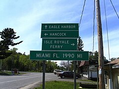
Copper Harbor에 있는 41마일 표지판에 플로리다 마이애미까지 가는 마일리지 표시
폴딩으로 들어가는 US 45

US 127 이스트 랜싱 통과
코빙턴 인근 US 141의 북쪽 종착역

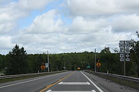
먼로 카운티의 US 23/US 223


.jpg)


특별경로
| 숫자 | 길이(미)[3] | 길이(km) | 남부 또는 서부 종착역 | 북부 또는 동부 종착역 | 형성된 | 제거된 | 메모들 | |
|---|---|---|---|---|---|---|---|---|
| 1.270 | 2.044 | 아이언우드의 위스콘신 주 노선 | 아이언우드의 US 2 | 1942[51] | 현재의 | 비즈니스 자극; 이전에 주 경계를 넘어 위스콘신[52] 주의 헐리까지 연결한 적이 있음 | ||
| 2.095 | 3.372 | 리드 시티의 US 10 | 리드 시티의 US 10 | c. 1960[53] | 현재의 | |||
| 5.002 | 8.050 | 그랜트-셰리단 구내선 US 127/US 10 | 와이즈 타운쉽의 US 10 | 1975[54] | 현재의 | 서비스 클레어 | ||
| 7.200 | 11.587 | 미들랜드의 US 10 | 미들랜드의 US 10과 M-20 | 1960[55] | 현재의 | 웨스턴 엔드는 미들랜드 카운티에 있고 동쪽 엔드는 베이[3] 카운티에 있다. | ||
| 14.767 | 23.765 | 모리스 타운쉽 산의 US 10 | 그랜드 블랑 타운쉽의 US 10 | 1941[56] | 1962[57] | 플린트를 대접하고 버스로 대체한다. M-54, 이후 로컬 제어로 복귀 | ||
| 6.925 | 11.145 | 워터포드 타운쉽의 US 10 | 블룸필드 타운쉽의 US 10 | 1961[58] | 1986[59] | 폰티악에게 봉사하고 버스로 대체한다. US 24 | ||
| 3.767 | 6.062 | 칼라마주에 있는 US 12 | 컴스톡의 US 12 | 1931[15] | 1954[60] | M-96으로 교체 | ||
| 11.955 | 19.240 | 텍사스 타운쉽의 I-94/US 12 | 컴스톡 타운쉽의 I-94/US 12 | 1959[61] | 1961[62] | 칼라마주 제공, BL I-94로 대체 | ||
| 9.678 | 15.575 | 배틀 크릭 타운쉽의 I-94/US 12 | 에밋 타운쉽의 I-94/US 12 | 1940[63] | 1961[64] | 배틀 크릭 서비스, BL I-94로 대체 | ||
| 3.716 | 5.980 | 마셜 타운쉽의 I-94/US 12 | 마렝고 타운쉽의 I-94/US 12 | 1960[65] | 1961[66] | 마샬 서비스, BL I-94로 대체 | ||
| 4.520 | 7.274 | 알비온의 I-94/US 12 | 파르마 타운쉽의 I-94/US 14 | 1960[65] | 1961[66] | BL I-94로 대체 | ||
| 10.274 | 16.534 | 블랙맨 타운쉽의 I-94/US 12 | 레오니 타운쉽의 I-94/US 12 | c. 1951[67] | 1960[68] | 서브 잭슨, BL I-94로 대체 | ||
| 5.327 | 8.573 | 버트랜드 타운쉽의 US 12 | 나일즈 타운쉽의 US 12와 M-51 | 1962[22] | 2010[69] | 서비스된 Niles, M-51, M-139로 대체 | ||
| 8.020 | 12.907 | I-94/US 12 in Ypsilanti | 밴 뷰런 타운쉽의 US 12 | 1962[22] | 현재의 | 버스 교체.US 112 | ||
| 20.197 | 32.504 | 워커 타운쉽의 US 16 | 캐스케이드 타운쉽의 US 16 | 1942[70] | 1953[71] | 우회 그랜드 래피드(Grand Rapids), 현재 M-11의 일부인 US 16 메인라인으로 대체됨 | ||
| 17.102 | 27.523 | 워커의 US 16 | 캐스케이드 타운쉽의 US 16 | 1953[71] | 1962[72] | 서비스된 그랜드 래피드(Grand Rapids), 로컬 제어로 돌아가기 | ||
| 3.863 | 6.217 | Farmington Hills의 US 16 | Farmington Hills의 US 16 | 1933[13] | 1956[73] | 바이패스된 Farmington, 현재 M-5의 일부인 미국 16번 간선으로 대체됨 | ||
| 4.129 | 6.645 | Farmington Hills의 US 16 | Farmington Hills의 US 16 | 1956[73] | 1961[74] | Farmington 제공, BL I-96으로 대체, 현재 서명되지 않음 | ||
| 5.781 | 9.304 | 피츠필드 타운쉽의 BL I-94/US 23 및 M-17 | 앤아버 타운쉽에서 US 23/M-14 | 1962[75] | 현재의 | 앤아버 섬김 | ||
| 3.009 | 4.843 | 펜턴의 US 23 | 펜턴의 US 23 | c. 1958[76] | 2006[77] | 1975년 이후 서명되지 않은 남부 1.723mi(2.773km),[78] 현재 도시 통제 하에 있음 | ||
| 8.006 | 12.884 | 브리지포트 타운쉽의 US 10/US 23 | US 23/M-81, 새기노 | 1953[79] | 1961[80] | BL I-75로 대체 | ||
| 2.714 | 4.368 | 베이 시티의 US 23 | 베이 시티의 US 23/M-47 및 M-20 | 1941[81] | 1961[82] | BL I-75/M-25 및 M-84로 교체 | ||
| 4.074 | 6.556 | 벨나프 타운쉽의 US 23 | 로저스 시티의 US 23 | 1942[83] | 현재의 | |||
| 33.783 | 54.368 | 에리 남쪽 오하이오 주 경계선 | 테일러의 US 25 | 1945[84] | 1959[21] | I-75로 대체 | ||
| 7.121 | 11.460 | 블룸필드 타운쉽의 US 24 | 워터포드 타운쉽의 US 24 | 1986[59] | 현재의 | 폰티액, 예전 버스. US 10 | ||
| 5.111 | 8.225 | 이리 타운쉽의 오하이오 주 경계선 | 에리 타운쉽의 US 25 | 1937[85] | 1945[84] | US 24A 이후 I-75로 대체 | ||
| 2.481 | 3.993 | 포트그라티엇 타운쉽의 M-51 | 포트 그라티오 타운쉽의 US 25 | 1940[86] | 1963[87] | US 25 이후 M-25로 대체 | ||
| 8.382 | 13.490 | 킴볼 타운쉽의 I-94/US 25 | 포트 그라티오 타운쉽의 US 25 | 1963[87] | 1973[88] | Marysville 및 Port Huron 서비스, M-25 및 이후 BL I-94로 대체 | ||
| 2.986 | 4.806 | 마셜 타운쉽의 I-69/US 27 및 BL I-94 | 마셜 타운쉽의 I-94 | 1967[89] | 1972[90] | 서비스 마샬, BL I-94와 동시에 제공되지 않는 섹션은 로컬 제어로 전환됨 | ||
| 4.891 | 7.871 | 카멜-에튼 군선 I-69/미국 27호 | 샬롯의 I-69/US 27 | 1961[91] | 1974[92] | BL I-69로 대체 | ||
| 1.529 | 2.461 | 랜싱의 US 27/M-78 | 랜싱의 US 27/M-78 | 1936[93] | 1950[94] | US 27로 대체 | ||
| 4.725 | 7.604 | 랜싱의 BL I-96 | 드위트 타운쉽의 I-69/US 27 | 1984[95] | 2002[96] | 서명되지 않은 버스로 대체됨. 랜싱의 US 127 | ||
| 8.808 | 14.175 | 올리브 타운쉽의 US 27 | 빙엄 타운쉽의 US 27 | 1998[97] | 2002[36] | 서빙 세인트. 존스; 버스로 대체. US 127 | ||
| 3.745 | 6.027 | 이타카-노스스타 타운쉽 선상 US 27 | 에머슨 타운쉽의 US 27 | 1961[98] | 2002[36] | 버스로 대체됨. US 127 | ||
| 5.255 | 8.457 | 알마 동쪽 27번지 | US 27과 M-46 서쪽에 위치한다. 루이 | 1929[14] | 1961[98] | 버스로 대체됨. US 27 | ||
| 5.631 | 9.062 | 에머슨-베서니 마을 회선의 US 27 | 파인 리버 타운쉽의 US 27 | 1961[98] | 2002[36] | 알마에서 근무함; US 27A를 대체하고 버스로 대체함. US 127 | ||
| 4.711 | 7.582 | 파인 강-베사니 마을 회선의 US 27 | 파인 리버 타운쉽의 US 27 | 1961[98] | 2002[36] | 서빙 세인트. 루이스; 버스로 대체되었다. US 127 | ||
| 5.688 | 9.154 | 유니온 타운쉽의 US 127 | 유니온 타운쉽의 US 127 | 1961[98] | 2002[36] | 기분 좋은 산을 섬기고, 버스로 대체했다. US 127 | ||
| 3.374 | 5.430 | 버논 타운쉽의 US 127 | 그랜트 타운쉽의 US 127/US 10 | 1961[98] | 2002[36] | 서비스 클레어, 버스로 대체. US 127 | ||
| 6.903 | 11.109 | 헤이스 타운쉽의 US 127과 M-61 | 헤이스 타운쉽의 US 127 | 1961[98] | 2002[36] | 해리슨을 섬기고 버스로 대체했다. US 127 | ||
| 3.587 | 5.773 | 버스. 미국 12번지 나일즈 | 나일즈 타운쉽의 구 US 31 | 1987[99] | 2010[100] | M-139로 대체 | ||
| 3.992 | 6.425 | 사우스 헤이븐 타운쉽의 US 31 | 카스코 타운쉽의 US 31 | c. 1942[101] | 1963[102] | 사우스 헤이븐 서비스, BL I-196으로 대체 | ||
| 4.120 | 6.630 | 네덜란드에서 BL I-196/US 31 | 홀랜드 타운쉽의 US 31과 BL I-196 | 1954[103] | 2004[104] | 도시 관리로 반환됨 | ||
| 4.763 | 7.665 | Muskegon 하이츠의 US 16과 US 31 | US 31 in Muskegon | 1932[16] | c. 1941[105] | 버스로 대체됨. US 31 | ||
| 9.870 | 15.884 | 노턴 해안에 있는 I-96과 US 31 | 북무스케곤의 US 31 | c. 1941[105] | 현재의 | Muskegon 서비스, US 31A 교체 | ||
| 4.680 | 7.532 | 화이트홀 타운쉽의 US 31 | 몬태규 타운쉽의 US 31 | 1964[106] | 현재의 | 화이트홀과 몬태규를 섬기다 | ||
| 2.138 | 3.441 | 하트 타운쉽의 US 31 | 하트의 존슨 앤 스테이트 거리 | 1987[107] | 현재의 | 사업촉진 | ||
| 7.151 | 11.508 | 위어 타운쉽의 US 31 | 펜트워터에 대한 미국 31세위어타운 선 | 1955[108] | 현재의 | 펜트워터 서비스 | ||
| 3.172 | 5.105 | 페레 마르켓 타운쉽의 US 31 | US 10 in Ludingt | 2005[109] | 현재의 | 사업촉진 | ||
| 2.343 | 3.771 | US 41/M-28, 마퀘트 | US 41/M-28, 마퀘트 | 1963[110] | 2005[111] | 도시 관리로 반환됨 | ||
| 4.873 | 7.842 | 이스페밍의 US 41/M-28 | 미국 41/M-28, Negaunee | 1937[112] | 1958[113] | 버스로 대체됨. M-28 | ||
| 4.256 | 6.849 | 바라가의 US 41 | 바라가 타운쉽의 US 41 | 1940[114] | 1942[115] | 로컬 제어로 반환됨 | ||
| 5.434 | 8.745 | 버트랜드 타운쉽의 US 112 | 밀턴 타운쉽의 US 112와 M-60 | c. 1956[116] | 1962[22] | 서브 나일즈, 버스로 대체. US 12 | ||
| 8.023 | 12.912 | 피츠필드 타운쉽의 US 112와 M-17 | 밴 뷰런 타운쉽의 US 112 | c. 1942[117] | 1956[118] | 바이패스된 Ypsilanti, I-94로 교체 | ||
| 8.020 | 12.907 | US 112 in Ypsilanti | 밴 뷰런 타운쉽의 US 112 | 1956[118] | 1962[22] | 버스로 대체됨. US 12 | ||
| 6.443 | 10.369 | 서밋 타운쉽에서 US 127과 M-50 | 블랙맨 타운쉽에서 I-94, US 127, M-50 | c. 1959[119] | 현재의 | 세브스 잭슨 | ||
| 2.369 | 3.813 | 메이슨에서 US 127 | 메이슨에서 US 127과 M-36 | c. 1946[120] | 1964[121] | M-36과 동시에 발생하지 않는 섹션이 로컬 제어로 전환됨 | ||
| 4.725 | 7.604 | 랜싱의 BL I-96 | 드위트 타운쉽의 I-69 | 2002[96] | 현재의 | 서명되지 않음, 버스 교체. US 27 | ||
| 8.808 | 14.175 | 올리브 타운쉽의 US 127 | 빙엄 타운쉽의 US 127 | 2002[36] | 현재의 | 서브스 세인트 존스; 버스를 대체했다. US 27 | ||
| 3.745 | 6.027 | 이타카-노스 스타 타운쉽에 있는 US 127 | 에머슨 타운쉽의 US 127 | 2002[36] | 현재의 | 버스 교체. US 27 | ||
| 5.631 | 9.062 | 에머슨-베서니 마을 회선의 US 127 | 파인 리버 타운쉽의 US 127 | 2002[36] | 현재의 | 알마 서비스, 버스 교체. US 27 | ||
| 4.711 | 7.582 | 파인 강-베사니 마을 회선의 US 127 | 파인 리버 타운쉽의 US 127 | 2002[36] | 현재의 | 서브스 세인트 Louis; Bus를 대신했다. US 27 | ||
| 5.688 | 9.154 | 유니온 타운쉽의 US 127 | 유니온 타운쉽의 US 127 | 2002[36] | 현재의 | 기분 좋은 산을 섬기고, 버스를 갈아타다. US 27 | ||
| 3.374 | 5.430 | 버논 타운쉽의 US 127 | 그랜트 타운쉽의 US 127/US 10 | 2002[36] | 현재의 | 클레어를 섬기고 버스를 교체한다. US 27 | ||
| 6.903 | 11.109 | 헤이스 타운쉽의 US 127과 M-61 | 헤이스 타운쉽의 US 127 | 2002[36] | 현재의 | 해리슨을 섬기고, 버스를 갈아타다. US 27 | ||
| 3.656 | 5.884 | 콘스탄티누스 타운쉽의 US 131 | 콘스탄티누스 타운쉽의 US 131 | 2013[122] | 현재의 | 콘스탄티누스를 섬기다. | ||
| 2.982 | 4.799 | US 131/M-60 3대강 살리기 | US 131 in 3 Rivers | 1953[123] | 현재의 | |||
| 4.198 | 6.756 | 칼라마주 타운쉽의 웨스트네지 애비뉴와 파크 스트리트 | 칼라마주 타운쉽의 US 131 | 1964[124] | 현재의 | 서비스 칼라마주 | ||
| 14.253 | 22.938 | 그랜드래피스의 US 131 | 플레인필드 타운쉽의 US 131 | 1945[125] | 1953[71] | M-11, M-37 및 M-44로 대체 | ||
| 2.419 | 3.893 | 그랜드래피스의 US 131 | 그랜드래피스의 I-296/US 131 | 1953[71] | 2017[126] | 로컬 제어로 반환됨 | ||
| 6.860 | 11.040 | 빅 래피즈 타운쉽에서 US 131/M-20 | 빅 래피즈 타운쉽의 US 131과 B-96 | 1983[127] | 현재의 | 빅 래피즈 서비스 | ||
| 5.597 | 9.007 | 클램 레이크 타운쉽의 US 131/M-55 | 헤링 타운쉽의 US 131 | 2001[38] | 현재의 | 캐딜락 서비스 | ||
| 5.667 | 9.120 | 시더크릭 타운쉽의 US 131과 M-42 | 리버티 타운쉽의 US 131 | 2003[39] | 현재의 | 서비스 맨턴 | ||
| 3.751 | 6.037 | US 223과 M-52 에이드리언 | 아드리안의 US 223 | c. 1956[128] | 현재의 | |||
| ||||||||
참고 항목
메모들
참조
각주
- ^ a b 맥니철(2006년), 페이지 74.
- ^ a b c d e f g h i j k l m n o p q r BPR&AASHO(1926년).
- ^ a b c d e f g h Michigan Department of Transportation (2021). Next Generation PR Finder (Map). Michigan Department of Transportation. Retrieved October 11, 2021.
- ^ 스위프트(2011), 페이지 5.
- ^ 해밀턴(2007년), 페이지 8.
- ^ American Association of State Highway and Transportation Officials (n.d.). "Standing Committee on Highways (SCOH) Overview". American Association of State Highway and Transportation Officials. Archived from the original on December 14, 2015. Retrieved January 5, 2016.
- ^ 맥니철(2006), 페이지 57, 121.
- ^ a b c 랜드 맥널리(2013), 페이지 50–1.
- ^ MDOT(2015b), 랜싱 인세트.
- ^ MDOT(2015a), § D4–D5.
- ^ a b c d "Continuation of Highway 141". The Manitowoc Herald-News. September 20, 1928. p. 13. Retrieved August 11, 2018 – via NewspaperArchive.com.
- ^ a b MSHD & 랜드 맥널리 (1935a); MSHD & 랜드 맥널리 (1935b)
- ^ a b c d MSHD & 랜드 맥널리 (1933a), MSHD & 랜드 맥널리 (1933b)
- ^ a b MSHD (1929), MSHD & H.M. 구샤 (1930)
- ^ a b MSHD & 랜드 맥널리(1931a), MSHD & 랜드 맥널리(1931b).
- ^ a b MSHD & Rand McNally(1932), Muskegon inset; MSHD & Rand McNally(1933a), Muskegon inset.
- ^ Kulsea & Shawver (1980), 페이지 27.
- ^ Kulsea & Shawver(1980), 페이지 30–31.
- ^ Kulsea & Shawver(1980), 페이지 17–18.
- ^ MSHD(1945), § M12.
- ^ a b "Interstate 75 Road Markers Are Unveiled". The Herald-Press. St. Joseph, Michigan. Associated Press. October 13, 1959. p. 3. OCLC 10117184. Retrieved July 11, 2018 – via Newspapers.com.
- ^ a b c d e f "Area Road Signs To Be Changed". The News-Palladium. Benton Harbor, Michigan. Associated Press. January 9, 1962. § 2, p. 5. Retrieved July 13, 2018 – via Newspapers.com.
- ^ a b MSHD(1962), § K8–M14, MSHD(1963), § K8–M14.
- ^ a b c "Will Eliminate US 25 Markings". Ironwood Daily Globe. Associated Press. p. 11. OCLC 10890811. Retrieved July 13, 2018 – via Newspapers.com.
- ^ "Highway Additions Requested By State". The Owosso Argus-Press. Associated Press. November 14, 1968. p. 7. OCLC 9802802. Retrieved December 5, 2010 – via Google News.
- ^ "News Capsules: Freeway". Ludington Daily News. November 2, 1976. p. 1. OCLC 27033604. Retrieved July 13, 2018 – via Newspapers.com.
- ^ Hoogterp, Ed (January 18, 1981). "US 131 Won't Hit the Straits". The Grand Rapids Press. pp. 1F, 2F. OCLC 9975013.
- ^ Conner, Robert E (April 11, 1979). "Removing I-296 Signs in Grand Rapids". Letter to Donald E. Trull. Washington, DC: Federal Highway Administration.
- ^ a b Kanillopoolos, John J. (October 19, 1982). "Dual and Triple Routing on State Trunklines". Letter to Trunkline Numbering Committee. Lansing: Michigan Department of Transportation. Retrieved June 3, 2019 – via Wikisource.
- ^ Kanillopoolos, John J. (March 17, 1983). "Dual and Triple Routing on State Trunklines". Letter to Trunkline Numbering Committee. Lansing: Michigan Department of Transportation. Retrieved June 3, 2019 – via Wikisource.
- ^ MDOT(1983년), § C10–C11, MDOT(1984년), § C10–C11.
- ^ MDOT(1986), § J11–M13, MDOT(1987), § J11–M13.
- ^ Special Committee on U.S. Route Numbering (June 9, 1986). "Route Numbering Committee Agenda" (Report). Washington, DC: American Association of State Highway and Transportation Officials. Retrieved April 9, 2015 – via Wikisource.
- ^ a b Special Committee on U.S. Route Numbering (April 27, 1997). "Report of the Special Committee on U.S. Route Numbering to the Standing Committee on Highways" (PDF) (Report). Washington, DC: American Association of State Highway and Transportation Officials. Archived (PDF) from the original on October 16, 2017. Retrieved April 9, 2015.
- ^ a b Special Committee on U.S. Route Numbering (April 17, 1999). "Report of the Special Committee on U.S. Route Numbering to the Standing Committee on Highways" (PDF) (Report). Washington, DC: American Association of State Highway and Transportation Officials. Archived (PDF) from the original on October 16, 2017. Retrieved May 24, 2008.
- ^ a b c d e f g h i j k l m n o MDOT(2002a), § G10–L11; MDOT(2003a), § G10–L11.
- ^ Truscott, John (August 31, 1998). "Governor Engler Opens US 27 Freeway" (Press release). Michigan Department of Transportation. Archived from the original on June 2, 2008. Retrieved May 24, 2008.
- ^ a b Bornheimer, Hank (October 27, 2001). "Temporary Recreation Trail Ready for Traffic—You Can Walk, Run, Skate or Bike the Cadillac Bypass—until Tuesday". The Grand Rapids Press. p. A1. OCLC 9975013.
- ^ a b MDOT(2003a), § H9; MDOT(2004a), § H9.
- ^ Aiken, Scott (August 23, 2003). "Better Late than Never: US 31 Freeway Finally Reaches Twin Cities". The Herald-Palladium. St. Joseph, Michigan. pp. 1A, 6A. OCLC 34793533. Retrieved July 13, 2018 – via Newspapers.com.
- ^ Martin, Julie A. (August 27, 2003). "US 31 in Berrien County Opens Today!" (Press release). Michigan Department of Transportation. Archived from the original on December 25, 2011. Retrieved March 26, 2013.
- ^ Rook, Christine (July 12, 2009). "Finishing US 127 Still Has Support". Lansing State Journal. pp. 1A, 4A. ISSN 0274-9742. OCLC 6678181. Retrieved July 13, 2018 – via Newspapers.com.
- ^ Michigan Department of Transportation (n.d.). "Overview". US 127 St. Johns to Ithaca Freeway. Michigan Department of Transportation. Retrieved June 15, 2016.
- ^ Aiken, Scott (October 20, 2013). "When, Oh When, Will 31 Be Done? MDOT Says Linking the Freeway to I-94 East of Benton Harbor Is Years Away". The Herald-Palladium. Benton Harbor, Michigan. Archived from the original on April 2, 2014. Retrieved November 13, 2013.
- ^ Haroldson, Tom (September 4, 2013). "MDOT Officials Concerned Funding Issues Can Delay, Kill Needed Projects". Kalamazoo Gazette. Archived from the original on April 2, 2014. Retrieved September 5, 2013.
- ^ Ranzenberger, Mark (April 27, 2008). "US 127 Signs Getting Updated". The Morning Sun. Mount Pleasant, Michigan. pp. 1A, 6A. OCLC 22378715.
- ^ "Route 33 Boosters to Meet at Harrisonburg, Va". Logan Daily News. October 8, 1940. p. 6. OCLC 71196386. Retrieved November 5, 2018 – via Newspapers.com.
- ^ "Portion of US 33 Is Now Indiana 933: Name Changes Along Lincoln Way, North to State Line". South Bend Tribune. April 18, 1998. p. A6. OCLC 8793233. Retrieved March 25, 2019 – via Newspapers.com.
- ^ MSHD & Rand McNally (1934), MSHD & Rand McNaly (1935a)
- ^ ODOH (1930); : ( ODOH (1931), §§ E4–B14.
- ^ "US 2 Business Route Through Ironwood". The Bessemer Herald. August 14, 1942. p. 7. Retrieved November 9, 2015 – via Newspapers.com.
- ^ WisDOT(2001), § E2; WisDOT(2003), § E2.
- ^ MSHD(1958), § I9; MSHD(1960), § I9.
- ^ MDSHT(1975), § I10; MDSHT(1976), 6 I10.
- ^ MSHD(1960), § J11; MSHD(1961), § J11.
- ^ MSHD & Rand McNally(1941a), § K12; MSHD & Rand McNally(1941b), § K12.
- ^ MSHD(1962), § K12, MSHD(1963), § K12.
- ^ MSHD(1960), 폰티악 인세트, MSHD(1961), 디트로이트 메트로폴리탄 지역 인세트, §§ A5-B6.
- ^ a b MDOT(1986), Detroit and Areast inset, § A6–B7; MDOT(1987), Detroit and Areast inset, § A6–B7.
- ^ MSHD(1954a), Kalamazoo inset, MSHD(1954b), Kalamazoo inset.
- ^ "Marshall and Area Chronology for 1959". Marshall Evening Chronicle. December 31, 1959. pp. 4–5. OCLC 18110507. Retrieved August 21, 2013 – via NewspaperArchive.com.
- ^ MSHD(1961), Kalamazoo inset; MSHD(1962), Kalamazoo inset.
- ^ MSHD & 랜드 맥널리(1940b), 배틀 크릭 인세트, MSHD & 랜드 맥널리(1940c), 배틀 크릭 인세트.
- ^ MSHD(1961), 배틀 크릭 인세트, MSHD(1962), 배틀 크릭 인세트.
- ^ a b MSHD(1960), § M10.
- ^ a b MSHD(1961), § M10.
- ^ MSHD(1951b), § M11; target:( MSHD(1952a), § M11. (
- ^ MSHD(1960), Jackson Inset; MSHD(1961), Jackson Inset.
- ^ Michigan Department of Transportation (May 7, 2010). "Contract Number 2010-0086". Michigan Department of Transportation. Retrieved May 7, 2010 – via Yahoo! Groups: Great Lakes Roads.
- ^ MSHD(1942년), 그랜드 래피즈 삽입.
- ^ a b c d MSHD(1953a), Grand Rapids inset, MSHD(1953b), Grand Rapids inset.
- ^ MSHD(1962), 그랜드 래피즈 삽입, MSHD(1963), 그랜드 래피즈 삽입.
- ^ a b MSHD(1956a), Detroit Area inset, (MSHD 1956b, Detroit Area inset),
- ^ MSHD(1961), Detroit Area inset; MSHD(1962), Detroit Area inset.
- ^ MSHD(1962), § M12, MSHD(1963), § M12.
- ^ MSHD(1958), § L12, MSHD(1960), § L12.
- ^ MDOT(2006), § L12; MDOT(2007), § L12.
- ^ MDSHT(1975), § L12; MDOT(1976), § L12. 오류:
- ^ MSHD(1953a), Saginaw inset, MSHD(1953b), Saginaw inset.
- ^ MSHD(1961), Saginaw inset, MSHD(1962), Saginaw inset.
- ^ MSHD & Rand McNally(1940c), Bay City inset; MSHD & Rand McNaly(1941a), Bay City inset.
- ^ MSHD(1960), Bay City inset; MSHD(1961), Bay City inset.
- ^ MSHD & Rand McNally(1941b), § E12; MSHD & Rand McNally(1942), § E12.
- ^ a b MSHD(1945), § N13.
- ^ MSHD & Rand McNally(1937a), § N13; MSHD & Rand McNally(1937b), § N13.
- ^ MSHD & Rand McNally(1939b), § K14; 대상 ( MSHD & Rand McNally(1940a), § K14.
- ^ a b MSHD(1963), § K14, MSHD(1964), § K14.
- ^ MDSH(1973), Port Huron inset, MDSHT(1974), Port Huron inset.
- ^ MDSH(1967), § M10, MDSH(1968), § M10.
- ^ MDSH(1972), § M10, MDSH(1973), § M10.
- ^ MSHD(1962), § L10, MSHD(1963), § L10.
- ^ MDSHT(1974), § L10, MDSHT(1975), § L10.
- ^ MSHD(1936a), 랜싱 인세트.
- ^ MSHD(1950a), 랜싱 인세트, MSHD(1950b), 랜싱 인세트.
- ^ MDOT(1984), Lansing inset; MDOT(1985), Lansing inset.
- ^ a b MDOT(2002b), Lansing inset; MDOT(2003b), Lansing inset.
- ^ MDOT(1998), § K11; MDOT(1999), § K11.
- ^ a b c d e f g MSHD(1961년), § I10–K11, MSHD(1962년), § I10–K11.
- ^ MDOT(1987), § N7–N8; MDOT(1988), § N7–N8. 대상
- ^ Schirripa, Nick (April 13, 2010). "US 12 BR Resurfacing in Niles to Start April 19" (Press release). Michigan Department of Transportation. Archived from the original on December 10, 2010. Retrieved April 28, 2010.
——— (April 22, 2010). "MDOT Meeting to Discuss Replacement of Historic Niles Bridge" (Press release). Michigan Department of Transportation. Archived from the original on October 12, 2012. Retrieved April 28, 2010. - ^ MSHD & Rand McNally(1942년), § M7; MSHD & Rand McNally(1943년), § M7.
- ^ MSHD(1963), § M7; MSHD(1964), § M7.
- ^ MSHD(1954a), § L8; MSHD(1954b), § L8.
- ^ MDOT(2004a), § L8; 대상 () MDOT(2005), § L8.
- ^ a b MSHD & Rand McNally1940c, Muskegon inset; MSHD & Rand McNaly(1941a), Muskegon inset.
- ^ MSHD(1964), § J7; MSHD(1965), § J7.
- ^ MDOT(1987), § J8; MDOT(1988), § J8. 오류:
- ^ MSHD(1955a), § J7; MSHD(1955b), § J7.
- ^ MDOT(2005), § I7; MDOT(2006), § I7.
- ^ "Bypass To Cut Travel Time by 20 Minutes". The Mining Journal. Marquette, Michigan. November 20, 1963. p. 13. ISSN 0898-4964. OCLC 9729223.
- ^ Garner, Dawn (November 9, 2005). "MDOT and City of Marquette Complete Jurisdictional Transfer" (Press release). Michigan Department of Transportation. Archived from the original on March 14, 2007. Retrieved July 31, 2008.
- ^ MSHD & Rand McNally(1937a), § C5; MSHD & Rand McNally(1937b), § C5.
- ^ MSHD(1958), § C5.
- ^ MSHD & Rand McNally(1939), § B4; MSHD & Rand McNally(1940a), § B4.
- ^ MSHD & Rand McNally(1942), § B4;
- ^ MSHD(1956b), Niles inset, MSHD(1957a), Niles inset.
- ^ MSHD & Rand McNally(1942년), § M12; MSHD & Rand McNally(1943년), § M12.
- ^ a b MSHD(1956a), § M12; MSHD(1956b), § M12.
- ^ MSHD(1958), Jackson Inset; MSHD(1960), Jackson Inset.
- ^ MSHD(1946), § M11, MSHD(1947), § M11.
- ^ MSHD(1964), § M11, MSHD(1965), § M11.
- ^ Westaby, Robb (October 30, 2013). "New US 131 Bypass Opens". Grand Rapids, Michigan: WXMI-TV. Retrieved October 30, 2013.
- ^ MSHD(1953a), § N9; MSHD(1953b), § N9.
- ^ MSHD(1964), Kalamazoo inset; MSHD(1965), Kalamazoo inset.
- ^ MSHD(1945), 그랜드 래피즈 삽입.
- ^ Special Committee on U.S. Route Numbering (May 22, 2018). "2018 Spring Meeting Report to the Council on Highways and Streets" (PDF) (Report). Washington, DC: American Association of State Highway and Transportation Officials. Archived (PDF) from the original on June 3, 2019.
- ^ MDOT(1983), § J9; MDOT(1984), § J9.
- ^ MSHD(1955b), § N12; MSHD(1956a), § N12.
인용된 작품
- Bureau of Public Roads & American Association of State Highway Officials (November 11, 1926). United States System of Highways Adopted for Uniform Marking by the American Association of State Highway Officials (Map). 1:7,000,000. Washington, DC: United States Geological Survey. OCLC 32889555. Retrieved November 7, 2013 – via Wikimedia Commons.
- Hamilton, William E. (February 2007). Act 51 Primer: A Guide to 1951 Public Act 51 and Michigan Transportation Funding (PDF) (Report). Lansing: Michigan House Fiscal Agency. Archived from the original (PDF) on July 3, 2010. Retrieved September 27, 2010.
- Kulsea, Bill & Shawver, Tom (1980). Making Michigan Move: A History of Michigan Highways and the Michigan Department of Transportation. Lansing: Michigan Department of Transportation. OCLC 8169232. Retrieved January 18, 2021 – via Wikisource.
- McNichol, Dan (2006). The Roads that Built America. New York: Sterling. ISBN 1-4027-3468-9. OCLC 63377558.
- Michigan Department of State Highways (1967). Michigan Water-Winter Wonderland: Official Highway Map (Map). [c. 1:918,720]. Lansing: Michigan Department of State Highways. OCLC 12701120. Retrieved October 17, 2019 – via Michigan History Center.
- ——— (1968). Official Highway Map (Map). [c. 1:918,720]. Lansing: Michigan Department of State Highways. OCLC 12701120. Retrieved October 17, 2019 – via Michigan History Center.
- ——— (1972). Michigan, Great Lake State: Official Highway Map (Map). c. 1:918,720. Lansing: Michigan Department of State Highways. OCLC 12701120.
- ——— (1973). Michigan, Great Lake State: Official Highway Map (Map). c. 1:918,720. Lansing: Michigan Department of State Highways. OCLC 12701120, 81679137. Retrieved October 17, 2019 – via Michigan History Center.
- Michigan Department of State Highways and Transportation (1974). Michigan, Great Lake State: Official Transportation Map (Map). c. 1:918,720. Lansing: Michigan Department of State Highways and Transportation. OCLC 12701177, 83138602. Retrieved October 17, 2019 – via Michigan History Center.
- ——— (1975). Michigan, Great Lake State: Official Transportation Map (Map). c. 1:918,720. Lansing: Michigan Department of State Highways and Transportation. OCLC 12701177, 320798754. Retrieved October 17, 2019 – via Michigan History Center.
- ——— (1976). Michigan, Great Lake State: Official Transportation Map (Map) (1976–1977 ed.). c. 1:918,720. Lansing: Michigan Department of State Highways and Transportation. OCLC 12701177. Retrieved October 17, 2019 – via Michigan History Center.
- Michigan Department of Transportation (1983). Say Yes to Michigan!: Official Transportation Map (Map). c. 1:918,720. Lansing: Michigan Department of Transportation. OCLC 12701177. Retrieved October 17, 2019 – via Michigan History Center.
- ——— (1984). Say Yes to Michigan!: Official Transportation Map (Map). c. 1:918,720. Lansing: Michigan Department of Transportation. OCLC 12701177. Retrieved October 17, 2019 – via Michigan History Center.
- ——— (1985). Yes Michigan: Official Transportation Map (Map). c. 1:918,720. Lansing: Michigan Department of Transportation. OCLC 12701177. Retrieved October 17, 2019 – via Michigan History Center.
- ——— (1986). Yes Michigan: Official Transportation Map (Map). c. 1:918,720. Lansing: Michigan Department of Transportation. OCLC 12701177. Retrieved October 17, 2019 – via Michigan History Center.
- ——— (1987). Yes Michigan: Official Transportation Map (Map). c. 1:918,720. Lansing: Michigan Department of Transportation. OCLC 12701177. Retrieved October 17, 2019 – via Michigan History Center.
- ——— (1998). Michigan Department of Transportation Map (Map). c. 1:918,720. Lansing: Michigan Department of Transportation. OCLC 42778335.
- ——— (1999). Michigan Department of Transportation Map (Map). c. 1:918,720. Lansing: Michigan Department of Transportation. OCLC 42778335, 55974644. Retrieved October 17, 2019 – via Michigan History Center.
- ——— (2002a). Michigan, Great Lakes Great Times: Official Department of Transportation Map (Map). c. 1:918,720. Lansing: Michigan Department of Transportation. OCLC 42778335.
- ——— (2002b). Truck Operator's Map (Map). Scale not given. Lansing: Michigan Department of Transportation.
- ——— (2003a). Michigan: Official Department of Transportation Map (Map) (2003–2004 ed.). c. 1:918,720. Lansing: Michigan Department of Transportation. OCLC 42778335. Retrieved October 17, 2019 – via Michigan History Center.
- ——— (2003b). Truck Operator's Map (Map). Scale not given. Lansing: Michigan Department of Transportation.
- ——— (2005). Michigan, One Hundred Years of Michigan Transportation: Official Department of Transportation Map (Map). c. 1:975,000. Lansing: Michigan Department of Transportation. OCLC 42778335, 71041619.
- ——— (2006). Michigan, A State for All Seasons: Official Department of Transportation Map (Map). c. 1:975,000. Lansing: Michigan Department of Transportation. OCLC 42778335.
- ——— (2007). Michigan: Official Department of Transportation Map (Map). c. 1:975,000. Lansing: Michigan Department of Transportation. OCLC 42778335. Archived from the original on August 27, 2019. Retrieved August 26, 2019 – via Archives of Michigan.
- ——— (2015a). Pure Michigan: State Transportation Map (Map). c. 1:975,000. Lansing: Michigan Department of Transportation. OCLC 42778335, 900162490.
- ——— (2015b). Truck Operator's Map (Map). Scale not given. Lansing: Michigan Department of Transportation.
- Michigan State Highway Department (May 1, 1929). Official Highway Service Map (Map). [c. 1:810,000]. Lansing: Michigan State Highway Department. OCLC 12701195, 79754957.
- ——— & H.M. Gousha (January 1, 1930). Official Highway Service Map (Map). [c. 1:810,000]. Lansing: Michigan State Highway Department. OCLC 12701195, 79754957.
- ——— & Rand McNally (May 15, 1931a). Official Highway Service Map (Map). [c. 1:840,000]. Lansing: Michigan State Highway Department. OCLC 12701053.
- ——— & ——— (October 1, 1931b). Official Highway Service Map (Map). [c. 1:840,000]. Lansing: Michigan State Highway Department. OCLC 12701053.
- ——— & ——— (October 1, 1932). Official Michigan Highway Map (Map). [c. 1:840,000]. Lansing: Michigan State Highway Department. OCLC 12701053.
- ——— & ——— (May 1, 1933a). Official Michigan Highway Map (Map). [c. 1:840,000]. Lansing: Michigan State Highway Department. OCLC 12701053. Archived from the original on May 10, 2017. Retrieved December 18, 2016 – via Archives of Michigan.
- ——— & ——— (September 1, 1933b). Official Michigan Highway Map (Map). [c. 1:840,000]. Lansing: Michigan State Highway Department. OCLC 12701053.
- ——— & ——— (September 1, 1934). Official Michigan Highway Map (Map). [c. 1:850,000]. Lansing: Michigan State Highway Department. OCLC 12701143.
- ——— & ——— (May 15, 1935a). Official Michigan Highway Map (Map). [c. 1:850,000]. Lansing: Michigan State Highway Department. OCLC 12701143.
- ——— & ——— (December 1, 1935b). Official Michigan Highway Map (Map). [c. 1:850,000]. Lansing: Michigan State Highway Department. OCLC 12701143.
- ——— & ——— (June 1, 1936). Official Michigan Highway Map (Map). [c. 1:850,000]. Lansing: Michigan State Highway Department. OCLC 12701143.
- ——— & ——— (May 15, 1937a). Official Michigan Highway Map (Map) (Summer ed.). [c. 1:850,000]. Lansing: Michigan State Highway Department. OCLC 12701143. Retrieved October 17, 2019 – via Michigan History Center.
- ——— & ——— (December 1, 1937b). Official Michigan Highway Map (Map) (Winter ed.). [c. 1:850,000]. Lansing: Michigan State Highway Department. OCLC 12701143. Retrieved October 17, 2019 – via Michigan History Center.
- ——— & ——— (December 1, 1939). Official Michigan Highway Map (Map) (Winter ed.). [c. 1:850,000]. Lansing: Michigan State Highway Department. OCLC 12701143. Retrieved October 17, 2019 – via Michigan History Center.
- ——— & ——— (April 15, 1940a). Official Michigan Highway Map (Map) (Spring ed.). [c. 1:850,000]. Lansing: Michigan State Highway Department. OCLC 12701143.
- ——— & ——— (July 15, 1940b). Official Michigan Highway Map (Map) (Summer ed.). [c. 1:850,000]. Lansing: Michigan State Highway Department. OCLC 12701143. Retrieved October 17, 2019 – via Michigan History Center.
- ——— & ——— (December 1, 1940c). Official Michigan Highway Map (Map) (Winter ed.). [c. 1:850,000]. Lansing: Michigan State Highway Department. OCLC 12701143.
- ——— & ——— (March 21, 1941a). Official Michigan Highway Map (Map) (Spring ed.). [c. 1:850,000]. Lansing: Michigan State Highway Department. OCLC 12701143.
- ——— & ——— (July 1, 1941b). Official Michigan Highway Map (Map) (Summer ed.). [c. 1:850,000]. Lansing: Michigan State Highway Department. OCLC 12701143. Archived from the original on April 22, 2017. Retrieved January 2, 2017 – via Archives of Michigan.
- ——— & ——— (June 1, 1942). Official Michigan Highway Map (Map) (Summer ed.). [c. 1:850,000]. Lansing: Michigan State Highway Department. OCLC 12701143.
- ——— & ——— (June 1, 1943). Official Michigan Highway Map (Map) (Summer ed.). [c. 1:850,000]. Lansing: Michigan State Highway Department.
- ——— (October 1, 1945). Official Highway Map of Michigan (Map). [c. 1:918,720]. Lansing: Michigan State Highway Department. OCLC 554645076.
- ——— (July 1, 1946). Michigan Official Highway Map (Map). [c. 1:918,720]. Lansing: Michigan State Highway Department. OCLC 12701120, 613361131. Retrieved October 17, 2019 – via Michigan History Center.
- ——— (May 1, 1947). Official Highway Map (Map). [c. 1:918,720]. Lansing: Michigan State Highway Department. OCLC 12701120, 494733404.
- ——— (April 15, 1950a). Michigan Official Highway Map (Map). [c. 1:918,720]. Lansing: Michigan State Highway Department. OCLC 12701120.
- ——— (July 1, 1950b). Official Highway Map (Map). [c. 1:918,720]. Lansing: Michigan State Highway Department. OCLC 12701120. Retrieved October 17, 2019 – via Michigan History Center.
- ——— (July 1, 1951). Official Highway Map (Map). [c. 1:918,720]. Lansing: Michigan State Highway Department. OCLC 12701120. Retrieved October 17, 2019 – via Michigan History Center.
- ——— (April 15, 1952). Official Highway Map (Map). [c. 1:918,720]. Lansing: Michigan State Highway Department. OCLC 12701120. Retrieved October 17, 2019 – via Michigan History Center.
- ——— (April 15, 1953a). Official Highway Map (Map). [c. 1:918,720]. Lansing: Michigan State Highway Department. OCLC 12701120.
- ——— (October 1, 1953b). Official Highway Map (Map). [c. 1:918,720]. Lansing: Michigan State Highway Department. OCLC 12701120. Retrieved October 17, 2019 – via Michigan History Center.
- ——— (April 15, 1954a). Michigan Water Wonderland: Official Highway Map (Map). [c. 1:918,720]. Lansing: Michigan State Highway Department. OCLC 12701120. Retrieved October 17, 2019 – via Michigan History Center.
- ——— (October 1, 1954b). Official Highway Map (Map). [c. 1:918,720]. Lansing: Michigan State Highway Department. OCLC 12701120.
- ——— (April 15, 1955a). Official Highway Map (Map). [c. 1:918,720]. Lansing: Michigan State Highway Department. OCLC 12701120. Retrieved October 17, 2019 – via Michigan History Center.
- ——— (October 1, 1955b). Official Highway Map (Map). [c. 1:918,720]. Lansing: Michigan State Highway Department. OCLC 12701120.
- ——— (April 15, 1956a). Official Highway Map (Map). [c. 1:918,720]. Lansing: Michigan State Highway Department. OCLC 12701120.
- ——— (October 1, 1956b). Official Highway Map (Map). [c. 1:918,720]. Lansing: Michigan State Highway Department. OCLC 12701120. Retrieved October 17, 2019 – via Michigan History Center.
- ——— (April 1, 1957). Official Highway Map (Map). [c. 1:918,720]. Lansing: Michigan State Highway Department. OCLC 12701120. Retrieved October 17, 2019 – via Michigan History Center.
- ——— (1958). Official Highway Map (Map). [c. 1:918,720]. Lansing: Michigan State Highway Department. OCLC 12701120, 51856742. Retrieved October 17, 2019 – via Michigan History Center. (1958년 7월 1일까지의 모든 변경 포함)
- ——— (1960). Official Highway Map (Map). [c. 1:918,720]. Lansing: Michigan State Highway Department. OCLC 12701120, 81552576. Retrieved October 17, 2019 – via Michigan History Center. (1960년 7월 1일까지의 모든 변경 포함)
- ——— (1961). Official Highway Map (Map). [c. 1:918,720]. Lansing: Michigan State Highway Department. OCLC 12701120, 51857665. Retrieved October 17, 2019 – via Michigan History Center. (1961년 7월 1일까지의 모든 변경 포함)
- ——— (1962). Official Highway Map (Map). [c. 1:918,720]. Lansing: Michigan State Highway Department. OCLC 12701120, 173191490. Retrieved October 17, 2019 – via Michigan History Center.
- ——— (1963). Official Highway Map (Map). [c. 1:918,720]. Lansing: Michigan State Highway Department. OCLC 12701120. Retrieved October 17, 2019 – via Michigan History Center.
- ——— (1964). Official Highway Map (Map). [c. 1:918,720]. Lansing: Michigan State Highway Department. OCLC 12701120, 81213707. Retrieved October 17, 2019 – via Michigan History Center.
- ——— (1965). Official Highway Map (Map). [c. 1:918,720]. Lansing: Michigan State Highway Department. OCLC 12701120. Retrieved October 17, 2019 – via Michigan History Center.
- Ohio Department of Highways (1930). Map of Ohio Showing State Highway System (PDF) (Map). 1:760,320. Columbus: Ohio Department of Highways. OCLC 5673562, 7237073. Retrieved December 31, 2010.
- ——— (1931). Map of Ohio Showing State Highway System (PDF) (Map). 1:760,320. Columbus: Ohio Department of Highways. OCLC 5673562, 7231737. Retrieved December 31, 2010.
- Rand McNally (2013). "Michigan" (Map). The Road Atlas. 1:1,267,200. Chicago: Rand McNally. pp. 50–1. ISBN 0-528-00626-6. OCLC 773666955.
- Swift, Earl (2011). The Big Roads: The Untold Story of the Engineers, Visionaries, and Trailblazers Who Created the American Superhighways. Boston: Mariner. ISBN 978-0-547-90724-6. OCLC 651911390.
- Wisconsin Department of Transportation (2001). Official State Highway Map (Map) (2001–02 ed.). 1:823,680. Madison: Wisconsin Department of Transportation.
- ——— (2003). Official State Highway Map (Map) (2003–04 ed.). 1:823,680. Madison: Wisconsin Department of Transportation.
외부 링크
| 위키미디어 커먼즈에는 미시간주에 있는 미국 고속도로와 관련된 미디어가 있다. |
경로 지도:
| KML 파일(편집 • 도움말) |


